|
search place name
|
||
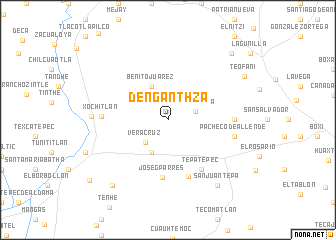
Denganthzá (Hidalgo, Mexico)Denganthzá is a town in the Hidalgo region of Mexico. An overview map of the region around Denganthzá is displayed below.
regional and 3d topo map of Denganthzá, Mexico ::
Denganthzá airports ::
The nearest airport is PCA - Pachuca Ingeniero Juan Guillermo Villasana, located 41.7 km south east of Denganthzá.
Other airports nearby include MEX - Mexico City Licenciado Benito Juarez Intl (93.8 km south), TLC - Toluca Licenciado Adolfo Lopez Mateos Intl (114.8 km south west), QRO - Queretaro Intercontinental (117.5 km west), TXA - Tlaxcala (128.7 km south east), Nearby towns ::
Los Mendoza (3.1km east) //
Veracruz (3.5km south west) //
Dos Cerritos (4.0km south west) //
Benito Juárez (4.1km north west) //
José G. Parres (6.5km south) //
El Mexe (6.5km south east) //
Tepatepec (6.5km south east) //
Luis Cárdenas (6.6km south) //
San Miguel Acambay (7.0km east) //
Xochitlán (7.0km west) //
Pacheco de Allende (7.2km east) //
La Ranchería (8.0km west) //
San Juan Tepa (9.0km south east) //
San Juan Tepa (9.0km south east) //
Árbol Grande (9.4km south west) //
Teofani (9.3km north east) //
Boxaxhi (10.0km north east) //
Palmillas (10.7km south west) //
[all distances 'as the bird flies' and approximate]  Places with similar names to Denganthzá, Mexico :: Disclaimer :: Information on this page comes without warranty of any kind |
||
|
Where is Denganthzá? Elevation and coordinates ::
Latitude (lat): 20°16'58"N Longitude (lon): 99°7'0"W
Elevation (approx.): 2316m (map arrows pan, magnifying glasses zoom) |
||
|
Visiting Denganthzá? Hotel/Accommodation ::
Book a hotel in Denganthzá Travel Guide ::
Buy a travel guide for Mexico rental cars ::
car rental offers GPS waypoint ::
download a GPX waypoint (PoI) of Denganthzá for your GPS receiver
|
||