|
search place name
|
||
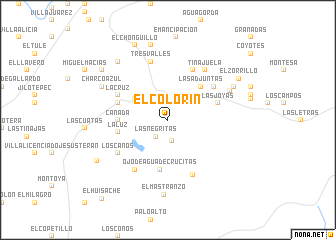
El Colorín (Aguascalientes, Mexico)El Colorín is a town in the Aguascalientes region of Mexico. An overview map of the region around El Colorín is displayed below.
regional and 3d topo map of El Colorín, Mexico ::
El Colorín airports ::
The nearest airport is AGU - Aguascalientes Jesus Teran Intl, located 51.3 km south west of El Colorín.
Other airports nearby include SLP - San Luis Potosi Ponciano Arriaga Intl (108.4 km east), BJX - Del Bajio Guanajuato Intl (123.3 km south east), ZCL - Zacatecas General Leobardo C Ruiz Intl (123.5 km north west), GDL - Guadalajara Don Miguel Hidalgo Y Costilla Intl (217.6 km south west), Nearby towns ::
Baciero (1.9km north) //
Las Negritas (2.3km south west) //
El Puertecito (2.4km south) //
Ojo de Agua (3.3km north east) //
La Esperanza (4.1km north west) //
Las Adjuntas (5.1km north east) //
Cañada (5.2km west) //
Ojo de Agua de Crucitas (5.6km south) //
La Luz (5.3km west) //
Las Joyas (5.5km east) //
Novillo (5.5km west) //
La Cruz (5.9km north west) //
Tanque Viejo (6.1km north east) //
Tanque de Guadalupe (6.0km north east) //
El Terremoto (6.5km south west) //
Los Caños (6.3km south west) //
Tres Valles (6.7km north) //
Juan Grande (6.7km south east) //
Tinajuela (6.8km north east) //
Fraguas (7.2km north east) //
Amarillas (7.8km north west) //
Charco Azul (7.8km north west) //
Epazote (7.8km north east) //
El Mastranzo (8.4km south) //
San Agustín (8.3km north west) //
Francisco Vitta (8.5km north) //
El Chonguillo (9.0km north) //
El Zorrillo (8.6km north east) //
Francisco Sarabia (8.6km south west) //
[all distances 'as the bird flies' and approximate]  Places with similar names to El Colorín, Mexico ::
// El Clarín (MX)
// El Clarín (MX)
// El Clarín (MX)
// El Clorón (MX)
// El Colorín (MX)
// El Colorín (MX)
// El Cuellareño (MX)
// El Clarín (VE)
Disclaimer :: Information on this page comes without warranty of any kind |
||
|
Where is El Colorín? Elevation and coordinates ::
Latitude (lat): 22°1'0"N Longitude (lon): 101°57'0"W
Elevation (approx.): 2058m (map arrows pan, magnifying glasses zoom) |
||
|
Visiting El Colorín? Hotel/Accommodation ::
Book a hotel in El Colorín Travel Guide ::
Buy a travel guide for Mexico rental cars ::
car rental offers GPS waypoint ::
download a GPX waypoint (PoI) of El Colorín for your GPS receiver
|
||