|
search place name
|
||
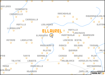
El Laurel (Chiapas, Mexico)El Laurel is a town in the Chiapas region of Mexico. An overview map of the region around El Laurel is displayed below.
regional and 3d topo map of El Laurel, Mexico ::
El Laurel airports ::
The nearest airport is MTT - Minatitlan, located 161.9 km north of El Laurel.
Other airports nearby include TGZ - Tuxtla Gutierrez Angel Albino Corzo (184.2 km east), HUX - Bahias Dehuatulco Bahias De Huatulco Intl (188.5 km south west), OAX - Oaxaca Xoxocotlan Intl (214.2 km west), VSA - Villahermosa C P A Carlos Rovirosa Intl (253.8 km north east), Nearby towns ::
Ciruela (1.9km north) //
San Pedro (2.6km north west) //
Las Conchas (3.0km north east) //
El Porvenir (3.5km west) //
Chucapa de Arriba (4.1km south west) //
Paso Lagarto (4.1km south west) //
Los Limones (4.1km north west) //
Emiliano Zapata (4.7km north east) //
Río Mico (5.1km south east) //
Puerta Vieja (5.3km east) //
La Chapopa (5.6km south east) //
Los Cocos (5.6km east) //
Palo Colorado (5.6km east) //
Llano Grande (5.8km south) //
Piletas (5.8km south) //
Los Nanches (6.6km south west) //
Agua Escondida (7.3km west) //
Portillo (7.3km east) //
Pila Común (7.6km north) //
Santo Domingo (8.2km south) //
San Pablo (8.2km south west) //
Ciénega (8.2km south east) //
La Blanca (8.5km south) //
Rancho Viejo (8.7km north east) //
Quemada (9.0km south east) //
Sitio Viejo (9.0km north east) //
Cieneguilla (9.0km north west) //
San Miguel Chimalapa (10.3km north east) //
Cuauhtémoc (10.7km north east) //
[all distances 'as the bird flies' and approximate] 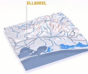 Places with similar names to El Laurel, Mexico ::
Disclaimer :: Information on this page comes without warranty of any kind |
||
|
Where is El Laurel? Elevation and coordinates ::
Latitude (lat): 16°39'0"N Longitude (lon): 94°45'0"W
Elevation (approx.): 258m (map arrows pan, magnifying glasses zoom) |
||
|
Visiting El Laurel? Hotel/Accommodation ::
Book a hotel in El Laurel Travel Guide ::
Buy a travel guide for Mexico rental cars ::
car rental offers GPS waypoint ::
download a GPX waypoint (PoI) of El Laurel for your GPS receiver
|
||