|
search place name
|
||
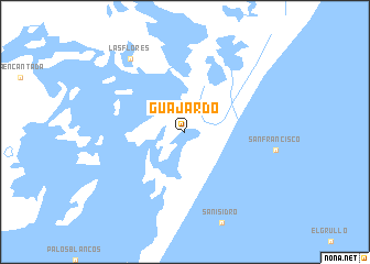
Guajardo (Tamaulipas, Mexico)Guajardo is a town in the Tamaulipas region of Mexico. An overview map of the region around Guajardo is displayed below.
regional and 3d topo map of Guajardo, Mexico ::
Guajardo airports ::
The nearest airport is MAM - Matamoros General Servando Canales Intl, located 46.4 km north of Guajardo.
Other airports nearby include BRO - Brownsville South Padre Island Intl (59.9 km north), HRL - Harlingen Valley Intl (98.8 km north), REX - Reynosa General Lucio Blanco Intl (109.4 km north west), MFE - Mcallen Mc Allen Miller Intl (122.9 km north west), Nearby towns ::
Las Flores (9.0km north west) //
[all distances 'as the bird flies' and approximate] 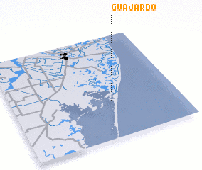 Places with similar names to Guajardo, Mexico ::
Disclaimer :: Information on this page comes without warranty of any kind |
||
|
Where is Guajardo? Elevation and coordinates ::
Latitude (lat): 25°22'0"N Longitude (lon): 97°24'0"W
Elevation (approx.): -32768m (map arrows pan, magnifying glasses zoom) |
||
|
Visiting Guajardo? Hotel/Accommodation ::
Book a hotel in Guajardo Travel Guide ::
Buy a travel guide for Mexico rental cars ::
car rental offers GPS waypoint ::
download a GPX waypoint (PoI) of Guajardo for your GPS receiver
|
||