|
search place name
|
||
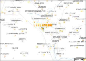
La Alameda (Guanajuato, Mexico)La Alameda is a town in the Guanajuato region of Mexico. An overview map of the region around La Alameda is displayed below.
regional and 3d topo map of La Alameda, Mexico ::
La Alameda airports ::
The nearest airport is QRO - Queretaro Intercontinental, located 53.7 km south east of La Alameda.
Other airports nearby include BJX - Del Bajio Guanajuato Intl (107.3 km west), SLP - San Luis Potosi Ponciano Arriaga Intl (144.1 km north), MLM - Morelia General Francisco J Mujica Intl (144.1 km south west), TSL - Tamuin (203.4 km north east), Nearby towns ::
Noria del Refugio (0.0km north) //
Huisache (2.0km north east) //
Galomo (2.5km north east) //
La Fragua (2.5km north west) //
El Cinco de Mayo (3.9km south east) //
Las Adjuntas (3.9km north east) //
El Ciprés (4.1km north east) //
La Concepción (4.4km north west) //
Tulillos de Arriba (4.7km north west) //
San Antonio (5.1km north west) //
Viborillas (5.4km north east) //
Cruz de la Maza (5.8km north) //
Arena de Abajo (6.8km south) //
Ojo de Diego (6.9km east) //
El Jovero (7.0km west) //
La Huerta (7.3km south east) //
Huisachal (7.6km north) //
Arena de Arriba (7.6km south) //
Los Vega de Abajo (7.3km north east) //
La Venta (7.6km south east) //
Puerto Blanco (7.8km north west) //
San José Iturbide (7.9km south east) //
La Canela (8.2km north east) //
La Yerbabuena (7.8km east) //
San Sebastián de Salitre (8.3km north) //
Cabú (8.3km north east) //
La Cinta (8.4km south) //
Pueblo Nuevo (8.5km north east) //
La Puerta (8.3km west) //
[all distances 'as the bird flies' and approximate] 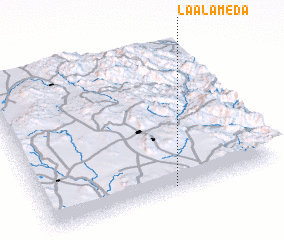 Places with similar names to La Alameda, Mexico ::
// La Lomita (PA)
// La Alameda (ES)
// La Alameda (ES)
// La Alameda (ES)
// La Alameda (ES)
// La Alameda (ES)
// La Olmeda (ES)
// La Olmeda (ES)
// La Alameda (CO)
// La Lomita (CO)
Disclaimer :: Information on this page comes without warranty of any kind |
||
|
Where is La Alameda? Elevation and coordinates ::
Latitude (lat): 21°2'0"N Longitude (lon): 100°27'0"W
Elevation (approx.): 2051m (map arrows pan, magnifying glasses zoom) |
||
|
Visiting La Alameda? Hotel/Accommodation ::
Book a hotel in La Alameda Travel Guide ::
Buy a travel guide for Mexico rental cars ::
car rental offers GPS waypoint ::
download a GPX waypoint (PoI) of La Alameda for your GPS receiver
|
||