|
search place name
|
||
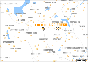
La Ciénega (México, Mexico)La Ciénega is a town in the México region of Mexico. An overview map of the region around La Ciénega is displayed below.
regional and 3d topo map of La Ciénega, Mexico ::
La Ciénega airports ::
The nearest airport is TLC - Toluca Licenciado Adolfo Lopez Mateos Intl, located 56.5 km south of La Ciénega.
Other airports nearby include MEX - Mexico City Licenciado Benito Juarez Intl (75.4 km south east), PCA - Pachuca Ingeniero Juan Guillermo Villasana (94.4 km east), QRO - Queretaro Intercontinental (102.5 km north west), CVJ - Cuernavaca General Mariano Matamoros (118.7 km south), Nearby towns ::
San Juan Tuxtepec (2.2km north east) //
Gran Puerto (4.0km north) //
San Felipe Coamango (4.1km east) //
San Marcos (4.6km south) //
San Gabriel (5.1km north) //
Xinté de Lagos (5.6km west) //
Cañada de Lobos (5.7km west) //
Rincón de Bucio (5.8km north west) //
La Ciénega (5.7km east) //
San José (5.9km south east) //
El Quinte (6.4km north) //
Santa Elena (6.1km north east) //
San Bartolo Morelos (6.4km south) //
Gallinas (6.5km north) //
Mota (6.7km north) //
Dongú (6.6km east) //
San Gregorio Macapexco (7.0km south) //
Bucio (7.0km north west) //
Cadenqui (7.0km south east) //
Casboncuac (7.2km south east) //
Agua Bendita (7.0km west) //
Santiago Acutzilapan (7.4km south west) //
José María Morelos y Pavón (7.6km north west) //
Bodenquí (7.5km east) //
La Loma (8.2km south) //
El Durazno de Cuauhtémoc (8.6km north east) //
El Palmito (9.0km north west) //
San Marcos Tlazalpan (8.7km south west) //
La Alameda (9.6km south east) //
[all distances 'as the bird flies' and approximate] 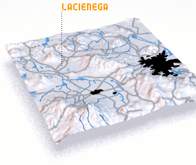 Places with similar names to La Ciénega, Mexico ::
Disclaimer :: Information on this page comes without warranty of any kind |
||
|
Where is La Ciénega? Elevation and coordinates ::
Latitude (lat): 19°50'30"N Longitude (lon): 99°39'0"W
Elevation (approx.): 2900m (map arrows pan, magnifying glasses zoom) |
||
|
Visiting La Ciénega? Hotel/Accommodation ::
Book a hotel in La Ciénega Travel Guide ::
Buy a travel guide for Mexico rental cars ::
car rental offers GPS waypoint ::
download a GPX waypoint (PoI) of La Ciénega for your GPS receiver
|
||