|
search place name
|
||
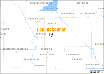
Laguna Grande (Tamaulipas, Mexico)Laguna Grande is a town in the Tamaulipas region of Mexico. An overview map of the region around Laguna Grande is displayed below.
regional and 3d topo map of Laguna Grande, Mexico ::
Laguna Grande airports ::
The nearest airport is MAM - Matamoros General Servando Canales Intl, located 46.6 km north east of Laguna Grande.
Other airports nearby include REX - Reynosa General Lucio Blanco Intl (53.2 km north west), BRO - Brownsville South Padre Island Intl (62.6 km north east), MFE - Mcallen Mc Allen Miller Intl (70.0 km north west), HRL - Harlingen Valley Intl (75.7 km north east), Nearby towns ::
San Isidro (3.3km west) //
La Capazón (3.7km north) //
Mario Sauza (5.0km west) //
El Palmito (5.8km south) //
La Argüelleña (7.6km south) //
Santa Apolonia (7.5km north west) //
La Encantada (8.9km north east) //
Dieciocho de Marzo (10.0km north east) //
La Chapeña (10.0km south east) //
[all distances 'as the bird flies' and approximate] 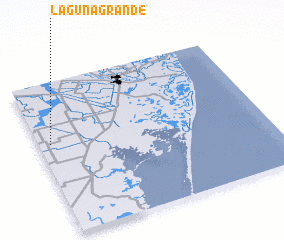 Places with similar names to Laguna Grande, Mexico ::
// Laguna Grande (MX)
// Laguna Grande (MX)
// Laguna Grande (MX)
// Laguna Grande (MX)
// Laguna Grande (MX)
// Laguna Grande (HN)
// Laguna Grande (HN)
// Laguna Grande (PE)
// Laguna Grande (VE)
// Laguna Grande (VE)
Disclaimer :: Information on this page comes without warranty of any kind |
||
|
Where is Laguna Grande? Elevation and coordinates ::
Latitude (lat): 25°36'0"N Longitude (lon): 97°57'0"W
Elevation (approx.): 19m (map arrows pan, magnifying glasses zoom) |
||
|
Visiting Laguna Grande? Hotel/Accommodation ::
Book a hotel in Laguna Grande Travel Guide ::
Buy a travel guide for Mexico rental cars ::
car rental offers GPS waypoint ::
download a GPX waypoint (PoI) of Laguna Grande for your GPS receiver
|
||