|
search place name
|
||
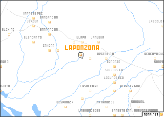
La Ponzoña (Chiapas, Mexico)La Ponzoña is a town in the Chiapas region of Mexico. An overview map of the region around La Ponzoña is displayed below.
regional and 3d topo map of La Ponzoña, Mexico ::
La Ponzoña airports ::
The nearest airport is TAP - Tapachula Intl, located 76.9 km south east of La Ponzoña.
Other airports nearby include TGZ - Tuxtla Gutierrez Angel Albino Corzo (136.3 km north), Nearby towns ::
Rancho Viejo (1.8km east) //
Ulapa (3.7km north) //
La Esperanza (4.1km north west) //
La Nueva (5.1km north east) //
Argentina (5.4km east) //
Monte Alto (5.7km west) //
Zamora (7.4km west) //
Bonanza (7.4km east) //
La Soledad (7.6km south) //
Soconusco (8.1km south east) //
Laguna Seca (9.1km south east) //
Barrancón (9.1km north west) //
San Juan (10.3km south east) //
Bandandón (11.0km north west) //
[all distances 'as the bird flies' and approximate] 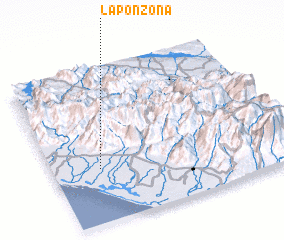 Places with similar names to La Ponzoña, Mexico ::
// La Ponzoña (NI)
// La Pinsonnie (FR)
Disclaimer :: Information on this page comes without warranty of any kind |
||
|
Where is La Ponzoña? Elevation and coordinates ::
Latitude (lat): 15°21'0"N Longitude (lon): 92°48'0"W
Elevation (approx.): 25m (map arrows pan, magnifying glasses zoom) |
||
|
Visiting La Ponzoña? Hotel/Accommodation ::
Book a hotel in La Ponzoña Travel Guide ::
Buy a travel guide for Mexico rental cars ::
car rental offers GPS waypoint ::
download a GPX waypoint (PoI) of La Ponzoña for your GPS receiver
|
||