|
search place name
|
||
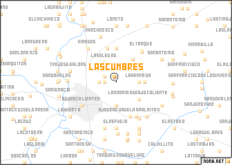
Las Cumbres (Aguascalientes, Mexico)Las Cumbres is a town in the Aguascalientes region of Mexico. An overview map of the region around Las Cumbres is displayed below.
regional and 3d topo map of Las Cumbres, Mexico ::
Las Cumbres airports ::
The nearest airport is AGU - Aguascalientes Jesus Teran Intl, located 24.4 km south of Las Cumbres.
Other airports nearby include ZCL - Zacatecas General Leobardo C Ruiz Intl (117.5 km north), BJX - Del Bajio Guanajuato Intl (129.6 km south east), SLP - San Luis Potosi Ponciano Arriaga Intl (141.2 km east), GDL - Guadalajara Don Miguel Hidalgo Y Costilla Intl (189.7 km south west), Nearby towns ::
Las Masas (1.7km west) //
La Higuerilla (2.0km north west) //
La Guayana (2.6km west) //
La Herrada (3.4km east) //
Salto de Ojo Caliente (3.7km south) //
La Soledad (3.7km north west) //
Las Norias de Ojo Caliente (4.4km south east) //
San Nicolás de Enmedio (4.5km north east) //
Conejal (4.3km east) //
Puertecito de la Virgen (5.6km north) //
El Puertecito (5.7km north) //
Ojo de Agua de las Palmitas (6.0km south) //
Las Crucitas (6.3km south east) //
San Nicolás de Arriba (6.3km north east) //
El Tanque (6.4km north east) //
Aguascalientes (6.4km south west) //
Asturias (6.8km south east) //
Viñedos (6.9km north west) //
El Refugio (7.4km south) //
Noria de Paso Hondo (7.2km south east) //
Trojes de Alonso (7.1km west) //
Casa Blanca (7.6km south) //
Rancho Seco (7.8km north) //
Los Coyotes (7.3km west) //
Paso Hondo (8.2km south east) //
Santoyo (8.2km south east) //
San Antonio (7.8km north east) //
La Camada (7.8km south east) //
Dolores (8.3km south) //
[all distances 'as the bird flies' and approximate]  Places with similar names to Las Cumbres, Mexico ::
// Las Cumbres (PA)
// Las Cumbres (CU)
// Las Chumberas (ES)
// Las Cumbres (CO)
// Los Guáimaros (CO)
// Los Gúaimaros (CO)
// Las Cumbres (MX)
// Las Cumbres (MX)
// Los Cúmaros (MX)
// Las Cumbres (VE)
Disclaimer :: Information on this page comes without warranty of any kind |
||
|
Where is Las Cumbres? Elevation and coordinates ::
Latitude (lat): 21°55'0"N Longitude (lon): 102°15'0"W
Elevation (approx.): 1976m (map arrows pan, magnifying glasses zoom) |
||
|
Visiting Las Cumbres? Hotel/Accommodation ::
Book a hotel in Las Cumbres Travel Guide ::
Buy a travel guide for Mexico rental cars ::
car rental offers GPS waypoint ::
download a GPX waypoint (PoI) of Las Cumbres for your GPS receiver
|
||