|
search place name
|
||
La Soledad (Guanajuato, Mexico)La Soledad is a town in the Guanajuato region of Mexico. An overview map of the region around La Soledad is displayed below.
regional and 3d topo map of La Soledad, Mexico ::

La Soledad airports ::
The nearest airport is BJX - Del Bajio Guanajuato Intl, located 44.1 km north of La Soledad.
Other airports nearby include MLM - Morelia General Francisco J Mujica Intl (92.6 km south east), ZMM - Zamora (108.8 km south west), QRO - Queretaro Intercontinental (128.3 km east), UPN - Uruapan Licenciado Y Gen Ignacio Lopez Rayon (148.3 km south west), Nearby towns ::
Dolores (1.9km north) //
Las Cruces (2.5km south west) //
Soledad (2.7km north) //
Santa Elena (2.7km north east) //
San José (2.8km south west) //
Providencia de Pérez (3.7km north west) //
Morelos (3.8km north west) //
El Coecillo (4.1km north) //
La Sauda (3.9km north east) //
Rosario de Covarrubias (4.9km north west) //
Rivera de Guadalupe (4.9km west) //
Yóstiro (5.1km south east) //
La Sonaja (5.2km east) //
Guadalupe (5.2km west) //
Tomelopitos (5.3km east) //
La Tinaja (5.7km south) //
Vista Hermosa (6.6km south west) //
Concepción (6.6km south west) //
Purísima (6.6km north east) //
Progreso de la Unión (6.9km south east) //
San José (7.1km south west) //
Purísima de Covarrubias (7.2km west) //
Santa Rita (7.2km west) //
San Ignacio de Rivera (7.4km south west) //
San Javier (7.8km north) //
San Cristóbal (7.6km north west) //
Santa Eulalia (8.0km south east) //
Bernales (8.1km south) //
El Carmen (7.9km north east) //
[all distances 'as the bird flies' and approximate] 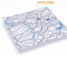 Places with similar names to La Soledad, Mexico ::
// La Soledad (PA)
// La Soledad (PA)
// La Soledad (PA)
// La Soledad (PA)
// La Soledad (CU)
// La Soledad (ES)
// La Soledad (CO)
// La Soledad (CO)
// La Soledad (CO)
// La Soledad (CO)
Disclaimer :: Information on this page comes without warranty of any kind |
||
|
Where is La Soledad? Elevation and coordinates ::
Latitude (lat): 20°36'0"N Longitude (lon): 101°25'0"W
Elevation (approx.): 1717m (map arrows pan, magnifying glasses zoom) |
||
|
Visiting La Soledad? Hotel/Accommodation ::
Book a hotel in La Soledad Travel Guide ::
Buy a travel guide for Mexico rental cars ::
car rental offers GPS waypoint ::
download a GPX waypoint (PoI) of La Soledad for your GPS receiver
|
||