|
search place name
|
||
La Virgen (México, Mexico)La Virgen is a town in the México region of Mexico. An overview map of the region around La Virgen is displayed below.
regional and 3d topo map of La Virgen, Mexico ::

La Virgen airports ::
The nearest airport is TLC - Toluca Licenciado Adolfo Lopez Mateos Intl, located 55.8 km south east of La Virgen.
Other airports nearby include MEX - Mexico City Licenciado Benito Juarez Intl (101.5 km east), MLM - Morelia General Francisco J Mujica Intl (108.7 km west), QRO - Queretaro Intercontinental (114.8 km north), CVJ - Cuernavaca General Mariano Matamoros (116.1 km south east), Nearby towns ::
Tres Estrellas (0.9km south) //
San Antonio Pueblo Nuevo (1.3km south west) //
San Nicolás Guadalupe (2.5km north) //
Agua Zarca (2.9km south) //
La Labor (2.8km east) //
El Salto (3.8km north west) //
El Ancón (4.6km north) //
El Lindero (4.7km south) //
Agua Zarca (4.7km south) //
Calvario del Carmen (5.0km north) //
San Antonio del Rincón (5.0km south) //
Dios Padre (5.2km north west) //
Santa Ana Nichi (5.6km east) //
San Antonio de las Huertas (6.0km south east) //
La Ciénega (6.1km north west) //
San Diego Suchitepec (6.5km south) //
Encinillas (6.5km north) //
San Miguel Agua Bendita (6.4km north west) //
Santa Ana (6.6km south west) //
Purísima Jaltepec (6.4km west) //
Estutempan (6.8km north east) //
San Antonio de la Ciénega (7.0km north) //
San Nicolás (6.7km south west) //
Loma de San José (7.0km south) //
La Soledad (7.4km north) //
San Juan Cote (7.2km east) //
El Cerrito (7.5km south east) //
San Jerónimo de los Dolores (7.8km north west) //
Nichi (7.8km north west) //
[all distances 'as the bird flies' and approximate] 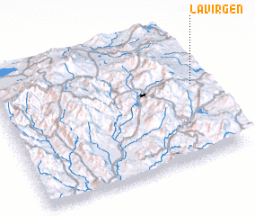 Places with similar names to La Virgen, Mexico ::
// La Vergine (IT)
// La Virginia (CU)
// La Virgen (ES)
// La Virgen (CO)
// La Virgen (CO)
// La Virgen (CO)
// La Virginia (CO)
// La Virginia (CO)
// La Virginia (CO)
// La Virginia (CO)
Disclaimer :: Information on this page comes without warranty of any kind |
||
|
Where is La Virgen? Elevation and coordinates ::
Latitude (lat): 19°35'30"N Longitude (lon): 100°1'30"W
Elevation (approx.): 2787m (map arrows pan, magnifying glasses zoom) |
||
|
Visiting La Virgen? Hotel/Accommodation ::
Book a hotel in La Virgen Travel Guide ::
Buy a travel guide for Mexico rental cars ::
car rental offers GPS waypoint ::
download a GPX waypoint (PoI) of La Virgen for your GPS receiver
|
||