|
search place name
|
||
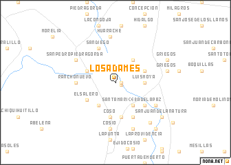
Los Adames (Aguascalientes, Mexico)Los Adames is a town in the Aguascalientes region of Mexico. An overview map of the region around Los Adames is displayed below.
regional and 3d topo map of Los Adames, Mexico ::
Los Adames airports ::
The nearest airport is ZCL - Zacatecas General Leobardo C Ruiz Intl, located 66.9 km north west of Los Adames.
Other airports nearby include AGU - Aguascalientes Jesus Teran Intl (78.8 km south), SLP - San Luis Potosi Ponciano Arriaga Intl (141.3 km east), BJX - Del Bajio Guanajuato Intl (178.5 km south east), GDL - Guadalajara Don Miguel Hidalgo Y Costilla Intl (234.9 km south west), Nearby towns ::
Guadalupito (0.9km east) //
La Soledad (0.9km east) //
Guadalupito (0.9km east) //
Esteban S. Castorena (4.5km north east) //
Luis Moya (4.3km east) //
Santa Mari(241)a de la Paz (4.5km south east) //
El Salero (4.5km south west) //
La Virgen (4.7km north west) //
Barranquilla (4.7km north east) //
El Salero (5.1km south west) //
Cosío (5.6km south) //
Coso (5.6km south) //
Refugio de Agua Zarca (5.6km south) //
Cuisillo (5.7km south east) //
El Refugio (6.1km south east) //
San Diego (6.1km north west) //
Rancho Nuevo (6.0km west) //
Huarache (7.5km north) //
San Pedro Piedra Gorda (7.0km north west) //
Cosío (7.5km south) //
Coecillo (7.1km south east) //
Refugio de Providencia (7.8km south) //
Griegos (7.9km east) //
San Jacinto (8.3km south east) //
Griegos (8.6km north east) //
San Juan de la Natura (8.8km south east) //
San Jacinto (9.5km south east) //
Huerta (9.5km south east) //
[all distances 'as the bird flies' and approximate] 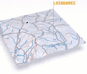 Places with similar names to Los Adames, Mexico ::
// Las Tumbas (PA)
// Las Damas (CU)
// Las Damas (CU)
// Las Tumbas (CU)
// Las Tumbas (CU)
// Los Tambos (CL)
// Los Tomes (CL)
// Las Damas (CO)
// Las Damas (CO)
// Las Damas (CO)
Disclaimer :: Information on this page comes without warranty of any kind |
||
|
Where is Los Adames? Elevation and coordinates ::
Latitude (lat): 22°25'0"N Longitude (lon): 102°17'30"W
Elevation (approx.): 1977m (map arrows pan, magnifying glasses zoom) |
||
|
Visiting Los Adames? Hotel/Accommodation ::
Book a hotel in Los Adames Travel Guide ::
Buy a travel guide for Mexico rental cars ::
car rental offers GPS waypoint ::
download a GPX waypoint (PoI) of Los Adames for your GPS receiver
|
||