|
search place name
|
||
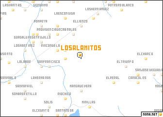
Los Alamitos (Zacatecas, Mexico)Los Alamitos is a town in the Zacatecas region of Mexico. An overview map of the region around Los Alamitos is displayed below.
regional and 3d topo map of Los Alamitos, Mexico ::
Los Alamitos airports ::
The nearest airport is ZCL - Zacatecas General Leobardo C Ruiz Intl, located 43.4 km east of Los Alamitos.
Other airports nearby include AGU - Aguascalientes Jesus Teran Intl (166.8 km south east), DGO - Durango Intl (190.6 km north west), TPQ - Tepic (254.6 km south west), Nearby towns ::
Boca del Río Chico (3.4km west) //
Los Hernillos (3.9km north west) //
Guanajuato (5.8km north) //
Rincón de la Florida (5.4km west) //
Manga de Vera (7.4km south) //
El Lienzo (7.4km north) //
San Francisco (7.1km west) //
Providencia de Cabrales (7.6km north west) //
El Peral (8.8km south east) //
Las Estacas (8.8km north west) //
Llanitos (9.0km north west) //
[all distances 'as the bird flies' and approximate] 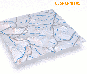 Places with similar names to Los Alamitos, Mexico ::
// Los Alamitos (US)
// Las Lomitas (PA)
// Las Lometas (CU)
// Las Lometas (CU)
// Los Límites (ES)
// Las Lomitas (US)
// Las Lomitas (CO)
// Las Lomitas (CO)
// Las Lomitas (CO)
// Las Lomitas (SV)
Disclaimer :: Information on this page comes without warranty of any kind |
||
|
Where is Los Alamitos? Elevation and coordinates ::
Latitude (lat): 23°2'0"N Longitude (lon): 103°5'0"W
Elevation (approx.): 2339m (map arrows pan, magnifying glasses zoom) |
||
|
Visiting Los Alamitos? Hotel/Accommodation ::
Book a hotel in Los Alamitos Travel Guide ::
Buy a travel guide for Mexico rental cars ::
car rental offers GPS waypoint ::
download a GPX waypoint (PoI) of Los Alamitos for your GPS receiver
|
||