|
search place name
|
||
Los Pérez (México, Mexico)Los Pérez is a town in the México region of Mexico. An overview map of the region around Los Pérez is displayed below.
regional and 3d topo map of Los Pérez, Mexico ::

Los Pérez airports ::
The nearest airport is CVJ - Cuernavaca General Mariano Matamoros, located 62.8 km east of Los Pérez.
Other airports nearby include TLC - Toluca Licenciado Adolfo Lopez Mateos Intl (71.5 km north east), MEX - Mexico City Licenciado Benito Juarez Intl (111.7 km north east), PBC - Puebla Hermanos Serdan Intl (162.1 km east), MLM - Morelia General Francisco J Mujica Intl (173.5 km north west), Nearby towns ::
Aquiapan (2.6km north east) //
Triguillos (2.6km north east) //
Aquiapan (2.6km south west) //
El Maniatl de Guadalupe (2.6km north west) //
La Canal (2.6km east) //
El Salto (3.3km north east) //
El Alacrán (3.3km south east) //
Ayotusco (3.5km east) //
Plan de Vigas (3.5km west) //
La Unión de Riva Palacio (4.0km north east) //
Cama de la Paz (4.0km south east) //
Agua Bendita (4.1km north west) //
San Miguel Tomaloya (4.0km south west) //
Yerbabuena (5.0km north) //
Coronas (5.0km south east) //
Río Florido (5.1km north east) //
Maniatl de Guadalupe de Abajo (5.1km north east) //
El Fresno (5.2km north east) //
El Calvario (5.2km south west) //
Mextepec (5.3km west) //
Huitzoltepec (5.6km east) //
Potzontepec (5.6km west) //
Yolotepec (6.1km south west) //
Campaña de Plata (6.4km south east) //
San Miguelito (6.4km north west) //
Teocalcingo (7.6km south) //
Zotzocola (7.4km east) //
Zacualpan (7.9km south east) //
El Verdecillo (8.2km south west) //
[all distances 'as the bird flies' and approximate] 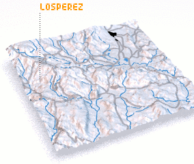 Places with similar names to Los Pérez, Mexico ::
// Lee Cypress (US)
// Los Pérez (PA)
// Los Pérez (PA)
// Los Pérez (PA)
// Los Pérez (PA)
// Los Piros (PA)
// Los Piros (PA)
// Las Parras (CU)
// Las Parras (CU)
// Los Perros (CU)
Disclaimer :: Information on this page comes without warranty of any kind |
||
|
Where is Los Pérez? Elevation and coordinates ::
Latitude (lat): 18°45'0"N Longitude (lon): 99°51'0"W
Elevation (approx.): 1950m (map arrows pan, magnifying glasses zoom) |
||
|
Visiting Los Pérez? Hotel/Accommodation ::
Book a hotel in Los Pérez Travel Guide ::
Buy a travel guide for Mexico rental cars ::
car rental offers GPS waypoint ::
download a GPX waypoint (PoI) of Los Pérez for your GPS receiver
|
||