|
search place name
|
||
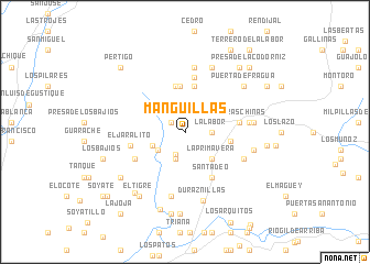
Manguillas (Aguascalientes, Mexico)Manguillas is a town in the Aguascalientes region of Mexico. An overview map of the region around Manguillas is displayed below.
regional and 3d topo map of Manguillas, Mexico ::
Manguillas airports ::
The nearest airport is AGU - Aguascalientes Jesus Teran Intl, located 50.5 km south east of Manguillas.
Other airports nearby include ZCL - Zacatecas General Leobardo C Ruiz Intl (104.0 km north), BJX - Del Bajio Guanajuato Intl (167.4 km south east), GDL - Guadalajara Don Miguel Hidalgo Y Costilla Intl (170.3 km south), SLP - San Luis Potosi Ponciano Arriaga Intl (188.0 km east), Nearby towns ::
La Pedrera (1.6km north west) //
Saltillo (2.5km south) //
La Labor (2.6km east) //
Mezquitillos (2.9km south) //
El Tepozán (3.2km south west) //
Cueva El Meco (3.3km south west) //
La Primavera (3.8km south east) //
El Temascal (4.7km north) //
Los Guajes (4.4km east) //
La Ordeña (4.7km north) //
Carboneras (4.7km north) //
San Tadeo (5.3km south east) //
La Boquilla (5.6km north) //
Piedras Chinas (5.2km east) //
El Jaralito (5.3km west) //
El Barreno (5.5km south west) //
El Jagúey (6.1km east) //
Las Minas (6.5km north) //
El Papanton (6.6km south) //
El Mirador (6.2km south east) //
El Zapote (6.5km east) //
Ciénega de Gallardo (7.0km north) //
Ojo de Agua de los Negros (6.7km east) //
Duraznillas (7.2km south) //
Puerta de Fragua (7.3km north east) //
El Chiquihuitero (7.6km south west) //
El Tigre (7.8km south west) //
El Chiquihuite (7.8km south west) //
Peña Blanca (8.2km south) //
[all distances 'as the bird flies' and approximate] 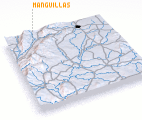 Places with similar names to Manguillas, Mexico ::
Disclaimer :: Information on this page comes without warranty of any kind |
||
|
Where is Manguillas? Elevation and coordinates ::
Latitude (lat): 21°57'30"N Longitude (lon): 102°43'30"W
Elevation (approx.): 1822m (map arrows pan, magnifying glasses zoom) |
||
|
Visiting Manguillas? Hotel/Accommodation ::
Book a hotel in Manguillas Travel Guide ::
Buy a travel guide for Mexico rental cars ::
car rental offers GPS waypoint ::
download a GPX waypoint (PoI) of Manguillas for your GPS receiver
|
||