|
search place name
|
||
Matarachi (Sonora, Mexico)Matarachi is a town in the Sonora region of Mexico. An overview map of the region around Matarachi is displayed below.
regional and 3d topo map of Matarachi, Mexico ::

Matarachi airports ::
The nearest airport is CEN - Ciudad Obregon Intl, located 170.5 km south west of Matarachi.
Other airports nearby include GYM - Guaymas General Jose Maria Yanez Intl (210.6 km south west), Nearby towns ::
Agua Buena (1.9km north) //
Cieneguita (7.4km north east) //
[all distances 'as the bird flies' and approximate] 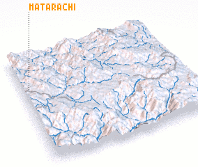 Places with similar names to Matarachi, Mexico ::
// Mitteraich (AT)
// Modriach (AT)
// Meiderich (DE)
// Mitteraich (DE)
// Motrich (DE)
// Madrisio (IT)
// Modrychi (UA)
// Mteurch (TN)
// Matarachi (MX)
// Mādar Shāh (IR)
Disclaimer :: Information on this page comes without warranty of any kind |
||
|
Where is Matarachi? Elevation and coordinates ::
Latitude (lat): 28°43'0"N Longitude (lon): 108°57'0"W
Elevation (approx.): 1378m (map arrows pan, magnifying glasses zoom) |
||
|
Visiting Matarachi? Hotel/Accommodation ::
Book a hotel in Matarachi Travel Guide ::
Buy a travel guide for Mexico rental cars ::
car rental offers GPS waypoint ::
download a GPX waypoint (PoI) of Matarachi for your GPS receiver
|
||