|
search place name
|
||
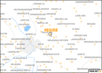
Medina (Guanajuato, Mexico)Medina is a town in the Guanajuato region of Mexico. An overview map of the region around Medina is displayed below.
regional and 3d topo map of Medina, Mexico ::
Medina airports ::
The nearest airport is BJX - Del Bajio Guanajuato Intl, located 22.4 km south east of Medina.
Other airports nearby include AGU - Aguascalientes Jesus Teran Intl (95.2 km north west), ZMM - Zamora (140.3 km south west), SLP - San Luis Potosi Ponciano Arriaga Intl (141.4 km north east), MLM - Morelia General Francisco J Mujica Intl (156.6 km south east), Nearby towns ::
Alfaro (1.0km east) //
Nuevo León (1.5km north west) //
Cañada (1.7km east) //
Los Naranjos (2.4km north west) //
San Pedro de los Hernández (3.4km south) //
San José del Potrero (3.3km south east) //
San José del Carmen (3.7km south) //
El Nido (4.1km south west) //
San José de Otates (3.9km north west) //
Ojo de Agua de los Reyes (4.2km north) //
Ibarrillas (5.0km north west) //
Sofía (5.1km south west) //
Echeveste (5.1km north west) //
San Nicolás de González (5.3km south east) //
Estancia de Otates (5.2km east) //
Santa Julia (5.8km south) //
León (6.4km south west) //
Gigante de Otates (6.4km north east) //
Pichinque (6.5km north west) //
Manzanillas (6.5km north east) //
Miravalle (6.9km west) //
Sangre de Cristo (7.4km south) //
Rancho de la Cruz (7.4km south) //
San Jorge (7.4km north) //
El Paraíso (7.2km west) //
Los Castillos (7.6km north west) //
San José de Alto (8.0km south) //
Otates (7.8km south east) //
Cañada de Ochoa (8.5km north west) //
[all distances 'as the bird flies' and approximate]  Places with similar names to Medina, Mexico ::
Disclaimer :: Information on this page comes without warranty of any kind |
||
|
Where is Medina? Elevation and coordinates ::
Latitude (lat): 21°9'0"N Longitude (lon): 101°37'0"W
Elevation (approx.): 1895m (map arrows pan, magnifying glasses zoom) |
||
|
Visiting Medina? Hotel/Accommodation ::
Book a hotel in Medina Travel Guide ::
Buy a travel guide for Mexico rental cars ::
car rental offers GPS waypoint ::
download a GPX waypoint (PoI) of Medina for your GPS receiver
|
||