|
search place name
|
||
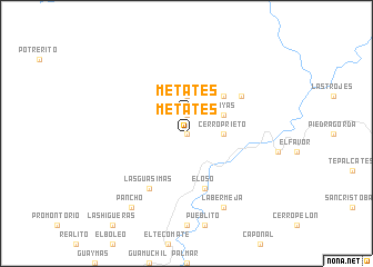
Metates (Sinaloa, Mexico)Metates is a town in the Sinaloa region of Mexico. An overview map of the region around Metates is displayed below.
regional and 3d topo map of Metates, Mexico ::
Metates airports ::
The nearest airport is MZT - Mazatlan General Rafael Buelna Intl, located 71.1 km south of Metates.
Other airports nearby include DGO - Durango Intl (158.3 km east), CUL - Culiacan Intl (183.4 km north west), Nearby towns ::
Pié de la Cuesta (0.0km north) //
Metates (1.9km north) //
Hacienda del Refugio (1.9km north) //
Cerro Prieto (3.4km east) //
Manzanillo (3.7km north) //
Playas (3.9km north east) //
El Pinto (5.0km north east) //
El Oso (5.8km south) //
Cerro Verde (6.3km north east) //
Las Guásimas (6.5km south west) //
La Bermeja (8.2km south east) //
Pancho (9.0km south west) //
[all distances 'as the bird flies' and approximate] 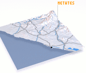 Places with similar names to Metates, Mexico ::
// Meadow Woods (US)
// Mautitz (DE)
// Mãe de Deus (PT)
// Medados (PT)
// Medio Dos (CU)
// Medtsy (UA)
// Mditsy (RU)
// Metates (MX)
// Metates (MX)
// Metates (MX)
Disclaimer :: Information on this page comes without warranty of any kind |
||
|
Where is Metates? Elevation and coordinates ::
Latitude (lat): 23°46'0"N Longitude (lon): 106°2'0"W
Elevation (approx.): 614m (map arrows pan, magnifying glasses zoom) |
||
|
Visiting Metates? Hotel/Accommodation ::
Book a hotel in Metates Travel Guide ::
Buy a travel guide for Mexico rental cars ::
car rental offers GPS waypoint ::
download a GPX waypoint (PoI) of Metates for your GPS receiver
|
||