|
search place name
|
||
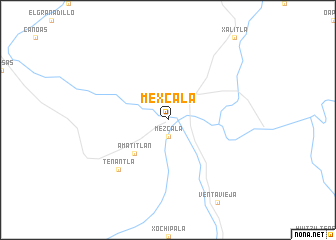
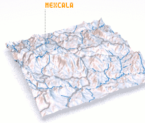
Mexcala (Guerrero, Mexico)Mexcala is a town in the Guerrero region of Mexico. An overview map of the region around Mexcala is displayed below.
regional and 3d topo map of Mexcala, Mexico ::
Mexcala airports ::
The nearest airport is CVJ - Cuernavaca General Mariano Matamoros, located 106.6 km north of Mexcala.
Other airports nearby include ACA - Acapulco General Juan N Alvarez Intl (131.0 km south), TLC - Toluca Licenciado Adolfo Lopez Mateos Intl (155.5 km north), MEX - Mexico City Licenciado Benito Juarez Intl (176.0 km north), PBC - Puebla Hermanos Serdan Intl (188.8 km north east), Nearby towns ::
 Places with similar names to Mexcala, Mexico ::
// Makasou Kola (CG)
// Mexcala (MX)
// Mexicali (MX)
// Mexiquillo (MX)
// Mexquillo (MX)
// Mäkiöiskylä (FI)
Disclaimer :: Information on this page comes without warranty of any kind |
||
|
Where is Mexcala? Elevation and coordinates ::
Latitude (lat): 17°56'0"N Longitude (lon): 99°37'0"W
Elevation (approx.): 473m (map arrows pan, magnifying glasses zoom) |
||
|
Visiting Mexcala? Hotel/Accommodation ::
Book a hotel in Mexcala Travel Guide ::
Buy a travel guide for Mexico rental cars ::
car rental offers GPS waypoint ::
download a GPX waypoint (PoI) of Mexcala for your GPS receiver
|
||