|
search place name
|
||
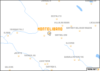
Monte Líbano (Chiapas, Mexico)Monte Líbano is a town in the Chiapas region of Mexico. An overview map of the region around Monte Líbano is displayed below.
regional and 3d topo map of Monte Líbano, Mexico ::
Monte Líbano airports ::
The nearest airport is TGZ - Tuxtla Gutierrez Angel Albino Corzo, located 154.3 km west of Monte Líbano.
Other airports nearby include VSA - Villahermosa C P A Carlos Rovirosa Intl (175.7 km north west), CME - Ciudad Del Carmen Intl (195.0 km north), CBV - Coban (204.9 km south east), Nearby towns ::
Placido Flores (2.1km west) //
Santa Elena (4.2km east) //
Villa Las Rosas (5.8km north east) //
Ocotalito (6.6km north) //
El Censo (8.4km south east) //
Rosario Río Blanco (8.5km north east) //
Taniperlas (11.2km south west) //
[all distances 'as the bird flies' and approximate] 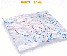 Places with similar names to Monte Líbano, Mexico ::
// Montalbano (IT)
// Montalbano (IT)
// Montalbán (ES)
// Montelíbano (CO)
// Montelíbano (CO)
// Monte Libano (MX)
// Montalban (VE)
// Montalbán (VE)
// Montalbán (VE)
// Monte Líbano (NI)
Disclaimer :: Information on this page comes without warranty of any kind |
||
|
Where is Monte Líbano? Elevation and coordinates ::
Latitude (lat): 16°54'0"N Longitude (lon): 91°37'20"W
Elevation (approx.): 657m (map arrows pan, magnifying glasses zoom) |
||
|
Visiting Monte Líbano? Hotel/Accommodation ::
Book a hotel in Monte Líbano Travel Guide ::
Buy a travel guide for Mexico rental cars ::
car rental offers GPS waypoint ::
download a GPX waypoint (PoI) of Monte Líbano for your GPS receiver
|
||