|
search place name
|
||
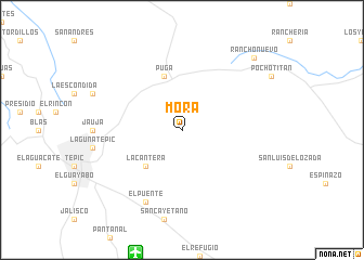
Mora (Nayarit, Mexico)Mora is a town in the Nayarit region of Mexico. An overview map of the region around Mora is displayed below.
regional and 3d topo map of Mora, Mexico ::
Mora airports ::
The nearest airport is TPQ - Tepic, located 13.4 km south of Mora.
Other airports nearby include PVR - Puerto Vallarta Licenciado Gustavo Diaz Ordaz Intl (105.6 km south west), GDL - Guadalajara Don Miguel Hidalgo Y Costilla Intl (191.0 km south east), MZT - Mazatlan General Rafael Buelna Intl (235.2 km north west), Nearby towns ::
La Cantera (5.1km south west) //
Puga (5.8km north) //
El Puente (8.2km south west) //
Rancho Nuevo (10.1km north east) //
[all distances 'as the bird flies' and approximate] 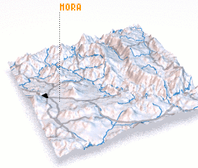 Places with similar names to Mora, Mexico ::
Disclaimer :: Information on this page comes without warranty of any kind |
||
|
Where is Mora? Elevation and coordinates ::
Latitude (lat): 21°32'0"N Longitude (lon): 104°48'0"W
Elevation (approx.): 979m (map arrows pan, magnifying glasses zoom) |
||
|
Visiting Mora? Hotel/Accommodation ::
Book a hotel in Mora Travel Guide ::
Buy a travel guide for Mexico rental cars ::
car rental offers GPS waypoint ::
download a GPX waypoint (PoI) of Mora for your GPS receiver
|
||