|
search place name
|
||
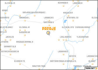
Paraje (Jalisco, Mexico)Paraje is a town in the Jalisco region of Mexico. An overview map of the region around Paraje is displayed below.
regional and 3d topo map of Paraje, Mexico ::
Paraje airports ::
The nearest airport is ZCL - Zacatecas General Leobardo C Ruiz Intl, located 91.5 km north east of Paraje.
Other airports nearby include AGU - Aguascalientes Jesus Teran Intl (118.5 km south east), TPQ - Tepic (187.4 km south west), GDL - Guadalajara Don Miguel Hidalgo Y Costilla Intl (195.1 km south), BJX - Del Bajio Guanajuato Intl (235.0 km south east), Nearby towns ::
Las Cañas (2.5km north east) //
Santa Inés (3.7km north) //
La Mesa de Marí de León (3.7km north) //
El Fraile (3.9km south east) //
Las Bocas (5.6km north) //
Las Huellas (5.5km east) //
Guanajuatillo (5.5km east) //
Las Liebres (6.3km east) //
El Cacalote (7.1km east) //
Las Animas (9.0km south east) //
San José de los Márquez (9.0km north west) //
Huejúcar (10.1km north east) //
[all distances 'as the bird flies' and approximate] 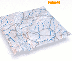 Places with similar names to Paraje, Mexico ::
Disclaimer :: Information on this page comes without warranty of any kind |
||
|
Where is Paraje? Elevation and coordinates ::
Latitude (lat): 22°17'0"N Longitude (lon): 103°17'0"W
Elevation (approx.): 2225m (map arrows pan, magnifying glasses zoom) |
||
|
Visiting Paraje? Hotel/Accommodation ::
Book a hotel in Paraje Travel Guide ::
Buy a travel guide for Mexico rental cars ::
car rental offers GPS waypoint ::
download a GPX waypoint (PoI) of Paraje for your GPS receiver
|
||