|
search place name
|
||
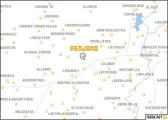
Pénjamo (Guanajuato, Mexico)Pénjamo is a town in the Guanajuato region of Mexico. An overview map of the region around Pénjamo is displayed below.
regional and 3d topo map of Pénjamo, Mexico ::
Pénjamo airports ::
The nearest airport is BJX - Del Bajio Guanajuato Intl, located 67.4 km north east of Pénjamo.
Other airports nearby include ZMM - Zamora (71.2 km south west), MLM - Morelia General Francisco J Mujica Intl (98.2 km south east), UPN - Uruapan Licenciado Y Gen Ignacio Lopez Rayon (119.1 km south), AGU - Aguascalientes Jesus Teran Intl (153.4 km north west), Nearby towns ::
Chiripitzio (1.9km south) //
Las Letras (2.4km north) //
Guanguítiro (3.4km west) //
San Miguel de Villaseñor (3.8km south east) //
La Tuza (4.1km south west) //
Los Gómez (4.3km south west) //
Magallanes (4.8km north east) //
El Volantín (5.2km west) //
La Labor (5.5km east) //
Estancia Pénjamo (6.1km south east) //
Sauz de Villaseñor (6.4km south) //
Mesa de Méndez (6.5km north west) //
La Trinidad (6.4km south east) //
Haciendita (6.4km south east) //
Tierras Negras (6.8km north) //
El Derramadero (6.4km east) //
El Sauz (6.9km south) //
La Lagunita (6.9km north east) //
Zapote de Barajas (7.2km south east) //
Las Ánimas (7.2km south west) //
Sauz Chico (7.6km south) //
La Tepuza (7.2km east) //
El Tigre (7.3km north west) //
El Gallo (8.1km north west) //
Zapote de Cestaú (8.0km north east) //
Colorado Saavedra (8.9km south) //
El Cobre (8.8km west) //
Palo Alto de Abajo (9.9km south west) //
La Granjena (9.9km south east) //
[all distances 'as the bird flies' and approximate]  Places with similar names to Pénjamo, Mexico ::
Disclaimer :: Information on this page comes without warranty of any kind |
||
|
Where is Pénjamo? Elevation and coordinates ::
Latitude (lat): 20°26'0"N Longitude (lon): 101°44'0"W
Elevation (approx.): 1814m (map arrows pan, magnifying glasses zoom) |
||
|
Visiting Pénjamo? Hotel/Accommodation ::
Book a hotel in Pénjamo Travel Guide ::
Buy a travel guide for Mexico rental cars ::
car rental offers GPS waypoint ::
download a GPX waypoint (PoI) of Pénjamo for your GPS receiver
|
||