|
search place name
|
||
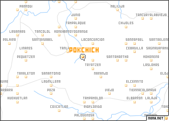
Pokchich (San Luis Potosí, Mexico)Pokchich is a town in the San Luis Potosí region of Mexico. An overview map of the region around Pokchich is displayed below.
regional and 3d topo map of Pokchich, Mexico ::
Pokchich airports ::
The nearest airport is TSL - Tamuin, located 43.1 km north of Pokchich.
Other airports nearby include TAM - Tampico General Francisco Javier Mina Intl (122.9 km north east), PCA - Pachuca Ingeniero Juan Guillermo Villasana (174.2 km south), QRO - Queretaro Intercontinental (181.1 km south west), PAZ - Poza Rico Tajin (183.8 km south east), Nearby towns ::
Cuayo-Ojex (1.7km east) //
San Cristóbal (1.9km north) //
Tayatzen (2.5km south east) //
La Concepción (4.1km north east) //
Santa Elena (3.9km north west) //
Tanlajás (3.9km north west) //
Naranjo (5.1km south east) //
Arroyo Grande (5.8km north) //
Santa Martha (6.9km east) //
Tampalaque (7.6km north) //
Monek (7.6km north west) //
San Antonio (7.8km south west) //
Ladrillera (8.9km south west) //
Argentina (9.0km north west) //
Viejo (9.0km south east) //
Poza (10.1km south west) //
[all distances 'as the bird flies' and approximate] 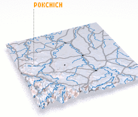 Places with similar names to Pokchich, Mexico ::
// Pokoshichi (UA)
// Pogoshche (BY)
Disclaimer :: Information on this page comes without warranty of any kind |
||
|
Where is Pokchich? Elevation and coordinates ::
Latitude (lat): 21°39'0"N Longitude (lon): 98°50'0"W
Elevation (approx.): 178m (map arrows pan, magnifying glasses zoom) |
||
|
Visiting Pokchich? Hotel/Accommodation ::
Book a hotel in Pokchich Travel Guide ::
Buy a travel guide for Mexico rental cars ::
car rental offers GPS waypoint ::
download a GPX waypoint (PoI) of Pokchich for your GPS receiver
|
||