|
search place name
|
||
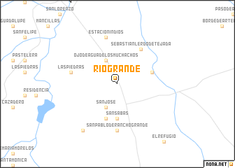
Río Grande (Zacatecas, Mexico)Río Grande is a town in the Zacatecas region of Mexico. An overview map of the region around Río Grande is displayed below.
regional and 3d topo map of Río Grande, Mexico ::
Río Grande airports ::
The nearest airport is ZCL - Zacatecas General Leobardo C Ruiz Intl, located 95.2 km south of Río Grande.
Other airports nearby include DGO - Durango Intl (165.2 km west), TRC - Torreon Intl (210.0 km north), Nearby towns ::
Ojo de Agua de los Muchachos (4.1km north west) //
San José (4.1km south west) //
San Sabás (5.6km south) //
Nueva Rosita (5.8km south) //
Hacienda Tetillas (5.4km east) //
Sebastián Lerdo de Tejada (6.5km north east) //
San Pablo de Rancho Grande (7.4km south) //
Las Piedras (7.0km west) //
Estación Indios (7.6km north) //
Carrizal (9.0km south west) //
[all distances 'as the bird flies' and approximate]  Places with similar names to Río Grande, Mexico ::
// Rio Grande (BR)
// Rio Grande (BR)
// Rio Grande (BR)
// Rio Grande (BR)
// Rio Grande (BR)
// Rio Grande (BR)
// Río Grande (PA)
// Río Grande (PA)
// Río Grande (PA)
// Rågrend (NO)
Disclaimer :: Information on this page comes without warranty of any kind |
||
|
Where is Río Grande? Elevation and coordinates ::
Latitude (lat): 23°43'0"N Longitude (lon): 102°58'0"W
Elevation (approx.): 2030m (map arrows pan, magnifying glasses zoom) |
||
|
Visiting Río Grande? Hotel/Accommodation ::
Book a hotel in Río Grande Travel Guide ::
Buy a travel guide for Mexico rental cars ::
car rental offers GPS waypoint ::
download a GPX waypoint (PoI) of Río Grande for your GPS receiver
|
||