|
search place name
|
||
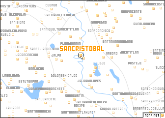
San Cristóbal (México, Mexico)San Cristóbal is a town in the México region of Mexico. An overview map of the region around San Cristóbal is displayed below.
regional and 3d topo map of San Cristóbal, Mexico ::
San Cristóbal airports ::
The nearest airport is TLC - Toluca Licenciado Adolfo Lopez Mateos Intl, located 52.2 km south east of San Cristóbal.
Other airports nearby include MEX - Mexico City Licenciado Benito Juarez Intl (90.0 km east), QRO - Queretaro Intercontinental (106.4 km north), CVJ - Cuernavaca General Mariano Matamoros (116.0 km south east), MLM - Morelia General Francisco J Mujica Intl (120.8 km west), Nearby towns ::
San Cristóbal Los Baños (0.3km north east) //
La Concepción (3.4km south east) //
Flor de María (3.7km north west) //
Jalpa Los Baños (3.7km south east) //
Rosa (4.1km south east) //
Colonia Benito Juárez (4.0km south east) //
Villejé (4.0km south east) //
Colonia Benito Juárez (4.0km south east) //
San Isidro Nanici (4.7km north) //
San Juan Xalpa (4.5km west) //
Las Ánimas (4.5km east) //
El Tunal Nenaxi (5.7km north west) //
Jalpa Dolores (6.0km south) //
Jalpa (5.6km west) //
Dolores Hidalgo (6.1km south west) //
Zacualpan (6.4km north east) //
Maboro (6.2km east) //
San Francisco (6.6km north east) //
San Pedro Los Baños (6.4km south east) //
San Antonio del Río (6.7km south) //
Emilio Portes Gil (7.1km south west) //
San Pedro El Chico (7.4km south) //
El Calvario (7.2km west) //
San Felipe del Progreso (7.3km west) //
Siffari (7.6km north east) //
San Antonio (7.6km north east) //
San Miguel Tenochtitlán (7.7km north west) //
San Pedro (8.2km north east) //
Tepetitlán (8.2km south west) //
[all distances 'as the bird flies' and approximate] 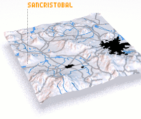 Places with similar names to San Cristóbal, Mexico ::
// San Cristóbal (PA)
// San Cristóbal (PA)
// San Cristóbal (PA)
// San Cristóbal (PA)
// San Cristóbal (PA)
// San Cristóbal (CU)
// San Cristóbal (CU)
// San Cristóbal (CU)
// San Cristóbal (CU)
// San Cristóbal (CU)
Disclaimer :: Information on this page comes without warranty of any kind |
||
|
Where is San Cristóbal? Elevation and coordinates ::
Latitude (lat): 19°42'0"N Longitude (lon): 99°53'0"W
Elevation (approx.): 2525m (map arrows pan, magnifying glasses zoom) |
||
|
Visiting San Cristóbal? Hotel/Accommodation ::
Book a hotel in San Cristóbal Travel Guide ::
Buy a travel guide for Mexico rental cars ::
car rental offers GPS waypoint ::
download a GPX waypoint (PoI) of San Cristóbal for your GPS receiver
|
||