|
search place name
|
||
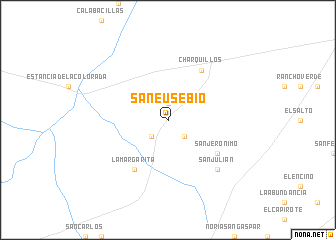
San Eusebio (Zacatecas, Mexico)San Eusebio is a town in the Zacatecas region of Mexico. An overview map of the region around San Eusebio is displayed below.
regional and 3d topo map of San Eusebio, Mexico ::
San Eusebio airports ::
The nearest airport is ZCL - Zacatecas General Leobardo C Ruiz Intl, located 102.4 km south west of San Eusebio.
Other airports nearby include SLP - San Luis Potosi Ponciano Arriaga Intl (217.1 km south east), TRC - Torreon Intl (230.7 km north west), SLW - Saltillo Plan De Guadalupe Intl (242.9 km north east), Nearby towns ::
Allende (1.9km north) //
La Puente (2.5km south east) //
El Muerto (2.5km south west) //
San Jerónimo (6.3km south east) //
Charquillos (6.5km north east) //
La Margarita (6.5km south west) //
San Julián (7.5km south east) //
Flores Magón (7.5km south east) //
[all distances 'as the bird flies' and approximate] 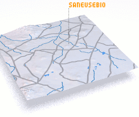 Places with similar names to San Eusebio, Mexico ::
// San Sabba (IT)
// San Sabba (IT)
// Sinsabaugh (US)
// San Saba (US)
// Sensibi (CD)
// San Eusebio (PE)
// Sen Sai (1) (LA)
Disclaimer :: Information on this page comes without warranty of any kind |
||
|
Where is San Eusebio? Elevation and coordinates ::
Latitude (lat): 23°45'0"N Longitude (lon): 102°18'0"W
Elevation (approx.): 1953m (map arrows pan, magnifying glasses zoom) |
||
|
Visiting San Eusebio? Hotel/Accommodation ::
Book a hotel in San Eusebio Travel Guide ::
Buy a travel guide for Mexico rental cars ::
car rental offers GPS waypoint ::
download a GPX waypoint (PoI) of San Eusebio for your GPS receiver
|
||