|
search place name
|
||
San Luis Taxhimay (México, Mexico)San Luis Taxhimay is a town in the México region of Mexico. An overview map of the region around San Luis Taxhimay is displayed below.
regional and 3d topo map of San Luis Taxhimay, Mexico ::

San Luis Taxhimay airports ::
The nearest airport is MEX - Mexico City Licenciado Benito Juarez Intl, located 56.4 km south east of San Luis Taxhimay.
Other airports nearby include TLC - Toluca Licenciado Adolfo Lopez Mateos Intl (58.3 km south), PCA - Pachuca Ingeniero Juan Guillermo Villasana (69.8 km east), CVJ - Cuernavaca General Mariano Matamoros (112.2 km south), QRO - Queretaro Intercontinental (118.9 km north west), Nearby towns ::
San Luis Loma Alta (1.1km west) //
San Luis Taxhimay (1.8km east) //
San Luis de las Peras (1.8km south west) //
La Cruz y Carrizal (2.7km south west) //
Tacximay (3.7km east) //
Las Moras (4.7km south) //
Toril (4.8km south) //
San Ignacio Nopala (4.8km east) //
San Ignacio Nopala (5.1km east) //
San José Piedra Gorda (5.4km south east) //
Shajay (5.3km east) //
Santa María Quelites (5.7km east) //
San Luis Anáhua (6.0km south east) //
Santiago Tlapanaloya (6.1km north east) //
Santa Ana Macavaca (6.5km west) //
El Capulín (7.0km north) //
Los Oratorios (6.9km south west) //
Tinajas (7.1km north east) //
Taxhidó (7.2km north east) //
Santiaguito (7.2km north east) //
La Loma (7.5km south east) //
San Salvador de la Laguna (7.6km south west) //
Barajas (7.9km west) //
Loma El Panal (8.5km north west) //
San Luis Taxhimáy (8.7km north) //
San Buenaventura (8.4km east) //
Tepeji de Ocampo (9.4km north east) //
Lagunilla (9.6km north west) //
La Cañada (10.1km south west) //
[all distances 'as the bird flies' and approximate] 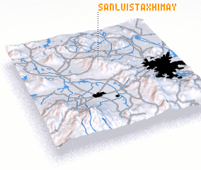 Places with similar names to San Luis Taxhimay, Mexico ::
// San Luis Taxhimay (MX)
// San Luis Taxhimáy (MX)
Disclaimer :: Information on this page comes without warranty of any kind |
||
|
Where is San Luis Taxhimay? Elevation and coordinates ::
Latitude (lat): 19°50'24"N Longitude (lon): 99°24'2"W
Elevation (approx.): 2233m (map arrows pan, magnifying glasses zoom) |
||
|
Visiting San Luis Taxhimay? Hotel/Accommodation ::
Book a hotel in San Luis Taxhimay Travel Guide ::
Buy a travel guide for Mexico rental cars ::
car rental offers GPS waypoint ::
download a GPX waypoint (PoI) of San Luis Taxhimay for your GPS receiver
|
||