|
search place name
|
||
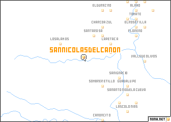
San Nicolás del Cañón (Chihuahua, Mexico)San Nicolás del Cañón is a town in the Chihuahua region of Mexico. An overview map of the region around San Nicolás del Cañón is displayed below.
regional and 3d topo map of San Nicolás del Cañón, Mexico ::
San Nicolás del Cañón airports ::
The nearest airport is CUU - Chihuahua General R Fierro Villalobos Intl, located 172.0 km north of San Nicolás del Cañón.
Nearby towns ::
Santa Rosa (5.8km north) //
San Javier (5.3km east) //
Los Álamos (6.2km north west) //
Sombreretillo (6.5km south east) //
La Cueva (6.5km north east) //
La Petaca (6.2km north east) //
San Ignacio (7.6km south east) //
Charco Azul (8.1km north east) //
[all distances 'as the bird flies' and approximate] 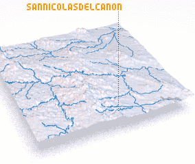 Places with similar names to San Nicolás del Cañón, Mexico :: Disclaimer :: Information on this page comes without warranty of any kind |
||
|
Where is San Nicolás del Cañón? Elevation and coordinates ::
Latitude (lat): 27°12'0"N Longitude (lon): 106°24'0"W
Elevation (approx.): 1548m (map arrows pan, magnifying glasses zoom) |
||
|
Visiting San Nicolás del Cañón? Hotel/Accommodation ::
Book a hotel in San Nicolás del Cañón Travel Guide ::
Buy a travel guide for Mexico rental cars ::
car rental offers GPS waypoint ::
download a GPX waypoint (PoI) of San Nicolás del Cañón for your GPS receiver
|
||