|
search place name
|
||
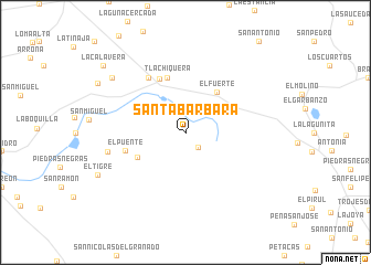
Santa Bárbara (Guanajuato, Mexico)Santa Bárbara is a town in the Guanajuato region of Mexico. An overview map of the region around Santa Bárbara is displayed below.
regional and 3d topo map of Santa Bárbara, Mexico ::
Santa Bárbara airports ::
The nearest airport is BJX - Del Bajio Guanajuato Intl, located 60.9 km south of Santa Bárbara.
Other airports nearby include SLP - San Luis Potosi Ponciano Arriaga Intl (91.7 km north east), AGU - Aguascalientes Jesus Teran Intl (100.3 km west), QRO - Queretaro Intercontinental (159.2 km south east), MLM - Morelia General Francisco J Mujica Intl (189.7 km south), Nearby towns ::
El Molcajete (1.9km south east) //
Buenos Aires (3.5km north east) //
Las Trojes (4.7km north west) //
El Fuerte (5.0km north east) //
San Elías (5.1km south west) //
Tlachiquera (5.8km north) //
Jesús María (5.9km north west) //
El Puente (6.0km west) //
Las Trojes (6.5km north west) //
El Cerrito (7.6km west) //
San Elías (8.9km north west) //
Callejón del Conejo (9.6km north west) //
La Calavera (10.2km north west) //
[all distances 'as the bird flies' and approximate]  Places with similar names to Santa Bárbara, Mexico ::
// Santa Bárbara (BR)
// Santa Bárbara (BR)
// Santa Bárbara (BR)
// Santa Bárbara (BR)
// Santa Bárbara (BR)
// Santa Bárbara (BR)
// Santa Bárbara (BR)
// Santa Bárbara (BR)
// Santa Bárbara (BR)
// Santa Bárbara (BR)
Disclaimer :: Information on this page comes without warranty of any kind |
||
|
Where is Santa Bárbara? Elevation and coordinates ::
Latitude (lat): 21°32'0"N Longitude (lon): 101°22'0"W
Elevation (approx.): 2257m (map arrows pan, magnifying glasses zoom) |
||
|
Visiting Santa Bárbara? Hotel/Accommodation ::
Book a hotel in Santa Bárbara Travel Guide ::
Buy a travel guide for Mexico rental cars ::
car rental offers GPS waypoint ::
download a GPX waypoint (PoI) of Santa Bárbara for your GPS receiver
|
||