|
search place name
|
||
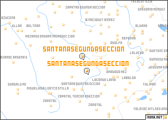
Santana Segunda Sección (Tabasco, Mexico)Santana Segunda Sección is a town in the Tabasco region of Mexico. An overview map of the region around Santana Segunda Sección is displayed below.
regional and 3d topo map of Santana Segunda Sección, Mexico ::
Santana Segunda Sección airports ::
The nearest airport is VSA - Villahermosa C P A Carlos Rovirosa Intl, located 68.1 km east of Santana Segunda Sección.
Other airports nearby include MTT - Minatitlan (121.7 km west), CME - Ciudad Del Carmen Intl (180.6 km east), TGZ - Tuxtla Gutierrez Angel Albino Corzo (183.7 km south), Nearby towns ::
San Vicente (0.9km south) //
La Arena Segunda Sección (2.6km east) //
Santana Tercera Sección (2.7km west) //
La Arena Tercera Sección (3.2km north east) //
Santana Segunda Sección (3.4km south) //
Carlos Greene Segunda Sección (3.5km north west) //
La Arena Quinta Sección (3.6km east) //
Santana Tercera Sección (3.7km north west) //
Arroyo Hondo Tercera Sección (3.9km north) //
Santana Cuarta Sección (4.6km south west) //
Libertad Primera Sección (5.2km east) //
Libertad (5.2km east) //
La Arena Cuarta Sección (5.8km north east) //
Santana Quinta Sección (6.5km south) //
Arroyo Hondo Segunda Sección (6.6km north) //
Retorno Primera Sección (6.6km east) //
Independencia (6.8km south) //
Carlos Greene Primera Sección (6.8km north) //
Francisco I. Madero (6.6km west) //
Arroyo Hondo Primera Sección (7.0km north east) //
La Candelaria (7.1km south east) //
Libertad Tercera Sección (7.2km south east) //
Adolfo (7.6km east) //
Amado Gómez (8.0km south east) //
Santana Primera Sección (8.2km south east) //
Poza Redonda Primera Sección (8.2km north west) //
Ignacio Gutierrez (8.6km north east) //
San Miguel (8.4km north east) //
Carlos Greene Tercera Sección (9.0km north west) //
[all distances 'as the bird flies' and approximate] 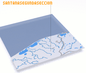 Places with similar names to Santana Segunda Sección, Mexico ::
// Santana Segunda Sección (MX)
Disclaimer :: Information on this page comes without warranty of any kind |
||
|
Where is Santana Segunda Sección? Elevation and coordinates ::
Latitude (lat): 18°10'30"N Longitude (lon): 93°26'0"W
Elevation (approx.): 13m (map arrows pan, magnifying glasses zoom) |
||
|
Visiting Santana Segunda Sección? Hotel/Accommodation ::
Book a hotel in Santana Segunda Sección Travel Guide ::
Buy a travel guide for Mexico rental cars ::
car rental offers GPS waypoint ::
download a GPX waypoint (PoI) of Santana Segunda Sección for your GPS receiver
|
||