|
search place name
|
||
Santiaguito Maxdá (México, Mexico)Santiaguito Maxdá is a town in the México region of Mexico. An overview map of the region around Santiaguito Maxdá is displayed below.
regional and 3d topo map of Santiaguito Maxdá, Mexico ::

Santiaguito Maxdá airports ::
The nearest airport is TLC - Toluca Licenciado Adolfo Lopez Mateos Intl, located 57.6 km south of Santiaguito Maxdá.
Other airports nearby include MEX - Mexico City Licenciado Benito Juarez Intl (84.3 km south east), QRO - Queretaro Intercontinental (98.4 km north west), PCA - Pachuca Ingeniero Juan Guillermo Villasana (106.7 km east), CVJ - Cuernavaca General Mariano Matamoros (121.4 km south east), Nearby towns ::
El Rincón (1.7km east) //
San Antonio Yondejé (2.6km north east) //
Isla de las Aves (3.0km north west) //
El Rinconcito (3.5km south east) //
El Salto (3.6km west) //
La Estancia (4.0km north west) //
San Vincente (4.1km south west) //
Santiago Acutzilapan (4.3km south) //
San Marcos Tlazalpan (4.9km south east) //
Magueyal (5.7km west) //
Pueblo Nuevo (6.5km south) //
San Pablo Atotonilco (6.5km west) //
Ocampo (6.9km north) //
Timilpan (6.8km north east) //
Atotonilco (6.8km south west) //
La Joya (6.7km west) //
San Pedro del Rosal (7.0km south west) //
Xinté de Lagos (6.9km east) //
Agua Bendita (7.3km north east) //
Zaragoza (8.3km north) //
Diximoxi (8.0km north west) //
Cañada de Lobos (8.1km north east) //
El Rincón (8.1km south west) //
San José del Tunal (8.2km west) //
San Francisco Chalchihuapan (8.5km south west) //
José María Morelos y Pavón (9.0km north east) //
La Campesina (9.2km north) //
San Antonio Enchisi (9.4km south west) //
Bucio (9.7km north east) //
[all distances 'as the bird flies' and approximate] 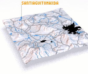 Places with similar names to Santiaguito Maxdá, Mexico :: Disclaimer :: Information on this page comes without warranty of any kind |
||
|
Where is Santiaguito Maxdá? Elevation and coordinates ::
Latitude (lat): 19°49'17"N Longitude (lon): 99°45'57"W
Elevation (approx.): 2762m (map arrows pan, magnifying glasses zoom) |
||
|
Visiting Santiaguito Maxdá? Hotel/Accommodation ::
Book a hotel in Santiaguito Maxdá Travel Guide ::
Buy a travel guide for Mexico rental cars ::
car rental offers GPS waypoint ::
download a GPX waypoint (PoI) of Santiaguito Maxdá for your GPS receiver
|
||