|
search place name
|
||
Zacayahuatl (Hidalgo, Mexico)Zacayahuatl is a town in the Hidalgo region of Mexico. An overview map of the region around Zacayahuatl is displayed below.
regional and 3d topo map of Zacayahuatl, Mexico ::

Zacayahuatl airports ::
The nearest airport is PAZ - Poza Rico Tajin, located 98.5 km east of Zacayahuatl.
Other airports nearby include PCA - Pachuca Ingeniero Juan Guillermo Villasana (100.4 km south west), TSL - Tamuin (135.4 km north), TXA - Tlaxcala (150.9 km south), TAM - Tampico General Francisco Javier Mina Intl (163.7 km north), Nearby towns ::
Huexotitla (2.7km south) //
Chiatitla (3.3km north east) //
Tetla (3.9km north) //
El Arenal (4.1km north west) //
Meneses (4.2km east) //
Pepeyocatitla (4.6km north west) //
Mecatlán (4.8km north) //
Atlaco (4.8km north east) //
Santa Teresa (4.7km west) //
Pohuantitla (5.6km south east) //
Pachiquitla (6.0km south east) //
Huitzaopala (6.2km north west) //
Huitztipán (6.4km south west) //
Toltepec (6.4km south west) //
Atlajco (6.3km east) //
Garcés (6.5km north east) //
Tecacalax (6.7km north west) //
Tecacahuaco (7.0km north) //
Tecopia (6.7km east) //
Pocantla (7.3km south east) //
Aguatitla (7.4km west) //
Yahualca (7.8km north) //
Zoquitipan (7.7km west) //
Xococapa (8.2km south) //
Yahualica (8.1km north west) //
Nuevo Acatepec (8.0km north east) //
Tlaltecatla (7.9km east) //
Xoxolpa (8.1km west) //
Mesa Larga (8.5km north west) //
[all distances 'as the bird flies' and approximate] 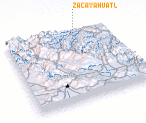 Places with similar names to Zacayahuatl, Mexico :: Disclaimer :: Information on this page comes without warranty of any kind |
||
|
Where is Zacayahuatl? Elevation and coordinates ::
Latitude (lat): 20°53'25"N Longitude (lon): 98°21'20"W
Elevation (approx.): 527m (map arrows pan, magnifying glasses zoom) |
||
|
Visiting Zacayahuatl? Hotel/Accommodation ::
Book a hotel in Zacayahuatl Travel Guide ::
Buy a travel guide for Mexico rental cars ::
car rental offers GPS waypoint ::
download a GPX waypoint (PoI) of Zacayahuatl for your GPS receiver
|
||