|
search place name
|
||
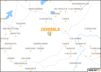
Zempoala (Puebla, Mexico)Zempoala is a town in the Puebla region of Mexico. An overview map of the region around Zempoala is displayed below.
regional and 3d topo map of Zempoala, Mexico ::
Zempoala airports ::
The nearest airport is TXA - Tlaxcala, located 64.8 km south of Zempoala.
Other airports nearby include PAZ - Poza Rico Tajin (79.2 km north east), PCA - Pachuca Ingeniero Juan Guillermo Villasana (81.9 km west), PBC - Puebla Hermanos Serdan Intl (111.3 km south), MEX - Mexico City Licenciado Benito Juarez Intl (134.2 km south west), Nearby towns ::
Cosamaloapan (5.1km south west) //
Chiconcuautla (5.5km east) //
Xilocuautla (5.8km north) //
Canoas (6.6km south west) //
Tlaxco (6.4km south east) //
Xaltepec (7.6km north) //
Tlaola (7.6km north east) //
Camotepec (8.9km south west) //
Tepeixco (8.9km south east) //
Tlalixtlipa (10.2km south east) //
[all distances 'as the bird flies' and approximate] 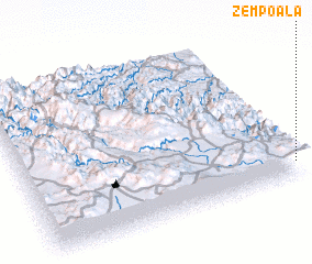 Places with similar names to Zempoala, Mexico ::
Disclaimer :: Information on this page comes without warranty of any kind |
||
|
Where is Zempoala? Elevation and coordinates ::
Latitude (lat): 20°6'0"N Longitude (lon): 98°0'0"W
Elevation (approx.): 1636m (map arrows pan, magnifying glasses zoom) |
||
|
Visiting Zempoala? Hotel/Accommodation ::
Book a hotel in Zempoala Travel Guide ::
Buy a travel guide for Mexico rental cars ::
car rental offers GPS waypoint ::
download a GPX waypoint (PoI) of Zempoala for your GPS receiver
|
||