|
search place name
|
||
Zocoyol (Durango, Mexico)Zocoyol is a town in the Durango region of Mexico. An overview map of the region around Zocoyol is displayed below.
regional and 3d topo map of Zocoyol, Mexico ::

Zocoyol airports ::
The nearest airport is TPQ - Tepic, located 145.5 km south of Zocoyol.
Other airports nearby include DGO - Durango Intl (162.0 km north), ZCL - Zacatecas General Leobardo C Ruiz Intl (177.8 km east), MZT - Mazatlan General Rafael Buelna Intl (199.1 km west), PVR - Puerto Vallarta Licenciado Gustavo Diaz Ordaz Intl (237.1 km south), Nearby towns ::
Obscuras (1.9km north) //
San Jerónimo (3.9km north west) //
Navío (4.1km north west) //
Tonalampa (5.0km south west) //
Taberna (5.1km east) //
Magueyitos (6.5km south west) //
Huasamota (6.3km south west) //
Muruguate (9.0km north west) //
Gachontita (8.8km north west) //
[all distances 'as the bird flies' and approximate] 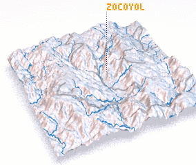 Places with similar names to Zocoyol, Mexico ::
// Xocoyolo (MX)
// Sakayelu (ZM)
// Sikhyŏl-li (KP)
// Sŏkhyŏl-li (KP)
// Sŏkhyŏl-li (KP)
// Sŏkhyŏl-li (KP)
// Sŏkhyŏl-li (KP)
// Sŏkhyŏl-li (KP)
// Sŏkhyŏl-li (KR)
// Sŏkkyeul (KR)
Disclaimer :: Information on this page comes without warranty of any kind |
||
|
Where is Zocoyol? Elevation and coordinates ::
Latitude (lat): 22°40'0"N Longitude (lon): 104°24'0"W
Elevation (approx.): 1922m (map arrows pan, magnifying glasses zoom) |
||
|
Visiting Zocoyol? Hotel/Accommodation ::
Book a hotel in Zocoyol Travel Guide ::
Buy a travel guide for Mexico rental cars ::
car rental offers GPS waypoint ::
download a GPX waypoint (PoI) of Zocoyol for your GPS receiver
|
||