|
search place name
|
||
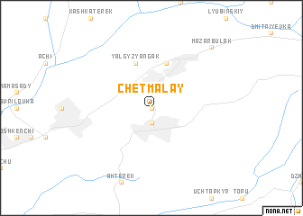
Chet-Malay (Kyrgyzstan)Chet-Malay is a town in Kyrgyzstan. An overview map of the region around Chet-Malay is displayed below.
regional and 3d topo map of Chet-Malay, Kyrgyzstan ::
Chet-Malay airports ::
The nearest airport is OSS - Osh, located 59.8 km south west of Chet-Malay.
Other airports nearby include DMB - Dzhambul Taraz (254.7 km north west), Nearby towns ::
Orto-Malay (0.0km north) //
Kok-Yangak (1.9km south) //
Mikhaylovka (5.7km north) //
Yalgyz-Yangak (5.7km north) //
Mazar-Bulak (9.3km north east) //
[all distances 'as the bird flies' and approximate]  Places with similar names to Chet-Malay, Kyrgyzstan ::
// Chetamale (IN)
// Chhutumel (IN)
// Chetumal (MX)
// Chitamal (MX)
// Chitambala (ZM)
// Chitambala (ZM)
// Chitambela (ZM)
// Siatimbula (ZM)
// Chad Mal (PK)
// Chitimela (MZ)
Disclaimer :: Information on this page comes without warranty of any kind |
||
|
Where is Chet-Malay? Elevation and coordinates ::
Latitude (lat): 41°3'0"N Longitude (lon): 73°12'0"E
Elevation (approx.): 1349m (map arrows pan, magnifying glasses zoom) |
||
|
Visiting Chet-Malay? Hotel/Accommodation ::
Book a hotel in Chet-Malay Travel Guide ::
Buy a travel guide for Kyrgyzstan rental cars ::
car rental offers GPS waypoint ::
download a GPX waypoint (PoI) of Chet-Malay for your GPS receiver
|
||