|
search place name
|
||
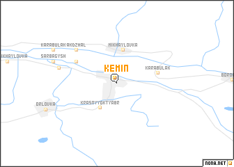
Kemin (Chüy, Kyrgyzstan)Kemin is a town in the Chüy region of Kyrgyzstan. An overview map of the region around Kemin is displayed below.
regional and 3d topo map of Kemin, Kyrgyzstan ::
Kemin airports ::
The nearest airport is FRU - Bishkek Manas, located 103.7 km west of Kemin.
Other airports nearby include ALA - Alma-ata Almaty (126.7 km north east), Nearby towns ::
Kemin (0.0km north) //
Krasnyy Oktyabrʼ (4.4km south west) //
Mikhaylovka (5.4km north) //
Karabulak (5.1km east) //
Belyy Piket (5.9km north west) //
Ak-Dzhal (7.1km north west) //
[all distances 'as the bird flies' and approximate] 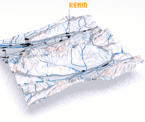 Places with similar names to Kemin, Kyrgyzstan ::
Disclaimer :: Information on this page comes without warranty of any kind |
||
|
Where is Kemin? Elevation and coordinates ::
Latitude (lat): 42°47'7"N Longitude (lon): 75°41'28"E
Elevation (approx.): 1123m (map arrows pan, magnifying glasses zoom) |
||
|
Visiting Kemin? Hotel/Accommodation ::
Book a hotel in Kemin Travel Guide ::
Buy a travel guide for Kyrgyzstan rental cars ::
car rental offers GPS waypoint ::
download a GPX waypoint (PoI) of Kemin for your GPS receiver
|
||