|
search place name
|
||
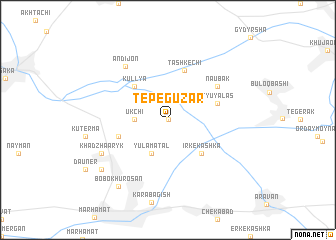
Tepe-Guzar (Kyrgyzstan)Tepe-Guzar is a town in Kyrgyzstan. An overview map of the region around Tepe-Guzar is displayed below.
regional and 3d topo map of Tepe-Guzar, Kyrgyzstan ::
Tepe-Guzar airports ::
The nearest airport is OSS - Osh, located 33.3 km east of Tepe-Guzar.
Nearby towns ::
Kusau (0.0km north) //
Chirtyk (0.0km north) //
Ukchi (2.8km west) //
Yulamatal (4.0km south) //
Irke-Kashka (4.7km south east) //
Kullya (4.7km north west) //
Tash-Kechi (5.7km north) //
Tyuyalasʼ (4.6km north east) //
Uchtepa (4.6km north east) //
Karakurgan (4.6km south west) //
Naubak (5.6km north east) //
Andijon (7.0km north west) //
Khadzhaaryk (6.7km south west) //
Shorkishlak (7.9km south west) //
Bobokhurosan (8.5km south west) //
[all distances 'as the bird flies' and approximate] 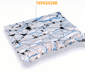
Disclaimer :: Information on this page comes without warranty of any kind |
||
|
Where is Tepe-Guzar? Elevation and coordinates ::
Latitude (lat): 40°36'0"N Longitude (lon): 72°24'0"E
Elevation (approx.): 586m (map arrows pan, magnifying glasses zoom) |
||
|
Visiting Tepe-Guzar? Hotel/Accommodation ::
Book a hotel in Tepe-Guzar Travel Guide ::
Buy a travel guide for Kyrgyzstan rental cars ::
car rental offers GPS waypoint ::
download a GPX waypoint (PoI) of Tepe-Guzar for your GPS receiver
|
||