|
search place name
|
||
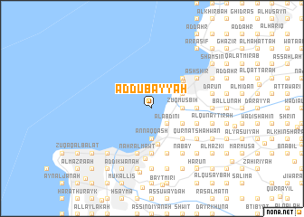
Aḑ Ḑubayyah (Mont-Liban, Lebanon)Aḑ Ḑubayyah is a town in the Mont-Liban region of Lebanon. An overview map of the region around Aḑ Ḑubayyah is displayed below.
regional and 3d topo map of Aḑ Ḑubayyah, Lebanon ::
Aḑ Ḑubayyah airports ::
The nearest airport is BEY - Beirut Rafic Hariri Intl, located 16.8 km south west of Aḑ Ḑubayyah.
Other airports nearby include DAM - Damascus Intl (105.0 km south east), RPN - Rosh Pina Mahanaim I Ben Yaakov (107.5 km south), HFA - Haifa (136.1 km south), LTK - Latakia Bassel Al Assad Intl (164.4 km north), Nearby towns ::
Balvū (2.4km south east) //
Al ‘Abdīnī (2.4km south east) //
‘Awkar (2.4km south east) //
Ḩārat al Ballānah (2.4km south east) //
Quţţā‘ ar Ruʼūs (3.7km south) //
An Naqqāsh (3.7km south) //
Zūq al Kharāb (3.1km east) //
Mazra‘at Abī Nādir (3.1km east) //
Makhāḑat Nahr al Kalb (3.1km east) //
Zūq Muşbiḩ (3.1km east) //
Ḩārat al Mīr (3.6km north east) //
Adūnīs (3.6km north east) //
Bayt ash Sha‘‘ār (3.6km south east) //
Dīk al Miḩdī (3.6km south east) //
Zūq Mīkhāʼīl (3.9km north east) //
Anţilyās (4.4km south) //
Joünié (4.7km north east) //
Şarbā (4.8km north east) //
Al Kaslīk (4.8km north east) //
Ar Rābiyah (4.8km south east) //
Al Muţaylib (4.8km south east) //
Mār Ilyās (4.6km east) //
‘Aynţūrah (4.6km east) //
Dayr aş Şalīb (5.6km south) //
Byāqūt (5.6km south) //
Jall adh Dhiʼb (5.6km south) //
Az Zalqāʼ (5.6km south) //
Bqinnāyā (5.6km south) //
Nahr al Mawt (5.8km south) //
[all distances 'as the bird flies' and approximate] 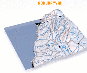 Places with similar names to Aḑ Ḑubayyah, Lebanon ::
Disclaimer :: Information on this page comes without warranty of any kind |
||
|
Where is Aḑ Ḑubayyah? Elevation and coordinates ::
Latitude (lat): 33°57'0"N Longitude (lon): 35°35'0"E
Elevation (approx.): -32768m (map arrows pan, magnifying glasses zoom) |
||
|
Visiting Aḑ Ḑubayyah? Hotel/Accommodation ::
Book a hotel in Aḑ Ḑubayyah Travel Guide ::
Buy a travel guide for Lebanon rental cars ::
car rental offers GPS waypoint ::
download a GPX waypoint (PoI) of Aḑ Ḑubayyah for your GPS receiver
|
||