|
search place name
|
||
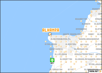
Al Ḩamrāʼ (Mont-Liban, Lebanon)Al Ḩamrāʼ is a town in the Mont-Liban region of Lebanon. An overview map of the region around Al Ḩamrāʼ is displayed below.
regional and 3d topo map of Al Ḩamrāʼ, Lebanon ::
Al Ḩamrāʼ airports ::
The nearest airport is BEY - Beirut Rafic Hariri Intl, located 8.8 km south of Al Ḩamrāʼ.
Other airports nearby include RPN - Rosh Pina Mahanaim I Ben Yaakov (102.3 km south), DAM - Damascus Intl (110.0 km south east), HFA - Haifa (127.7 km south), LTK - Latakia Bassel Al Assad Intl (171.9 km north), Nearby towns ::
Al Qanţārī (0.0km north) //
‘Ayn al Muraysá (0.0km north) //
Raʼs Bayrūt (0.0km north) //
Al Marfaʼ (1.5km east) //
Zuqāq al Balāţ (1.5km east) //
Mīnāʼ al Ḩişn (1.5km east) //
Aş Şayfī (1.5km east) //
Ar Rawshah (2.4km south west) //
Al Mazra‘ah (2.4km south east) //
Al Muşayţbah (2.4km south east) //
An Nāşirah (2.4km south east) //
Al Bāshūrah (2.4km south east) //
‘Ayn al Janāḩ (3.7km south) //
Ramlat al Bayḑāʼ (3.7km south) //
Ar Rumayl (3.1km east) //
Raʼs an Nab‘an (4.0km south east) //
Al Ashrafīyah (3.6km south east) //
Beyrouth (4.0km south east) //
Taḩwīţat an Nahr (4.8km south east) //
Furn ash Shubbāk (4.8km south east) //
Mār Nahrā (4.8km south east) //
An Nabī al Awzā‘ī (5.6km south) //
Al Mudawwar (4.6km east) //
Dawrā (4.6km east) //
Ḩārat Ḩurayk (5.8km south) //
Biʼr Ḩasan (5.8km south) //
Marāşifah (5.0km east) //
Burj Ḩammūd (5.0km east) //
Sinn al Fīl (5.0km east) //
[all distances 'as the bird flies' and approximate]  Places with similar names to Al Ḩamrāʼ, Lebanon ::
// Al Ḩumayrah (IQ)
// Al Ḩamrah (EG)
// Alhambra (ES)
// Al Hamra (TD)
// Al Ḩumayrah (LB)
// Al Ḩamar (SA)
// Al Ḩumr (SD)
// Al Ḩummar (JO)
// Al Ḩamrā (SY)
// Al Ḩaymar (SY)
Disclaimer :: Information on this page comes without warranty of any kind |
||
|
Where is Al Ḩamrāʼ? Elevation and coordinates ::
Latitude (lat): 33°54'0"N Longitude (lon): 35°29'0"E
Elevation (approx.): 32m (map arrows pan, magnifying glasses zoom) |
||
|
Visiting Al Ḩamrāʼ? Hotel/Accommodation ::
Book a hotel in Al Ḩamrāʼ Travel Guide ::
Buy a travel guide for Lebanon rental cars ::
car rental offers GPS waypoint ::
download a GPX waypoint (PoI) of Al Ḩamrāʼ for your GPS receiver
|
||