|
search place name
|
||
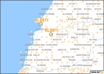
Al Qāţi‘ (Mont-Liban, Lebanon)Al Qāţi‘ is a town in the Mont-Liban region of Lebanon. An overview map of the region around Al Qāţi‘ is displayed below.
regional and 3d topo map of Al Qāţi‘, Lebanon ::
Al Qāţi‘ airports ::
The nearest airport is BEY - Beirut Rafic Hariri Intl, located 15.3 km north of Al Qāţi‘.
Other airports nearby include RPN - Rosh Pina Mahanaim I Ben Yaakov (78.3 km south), DAM - Damascus Intl (100.4 km east), HFA - Haifa (105.2 km south west), OMF - Mafraq King Hussein (164.1 km south east), Nearby towns ::
Marāḩ aţ Ţīţ (0.0km north) //
Al Fukhaytah (0.0km north) //
Al Bāshiqīyah (0.0km north) //
‘Aqlīn (0.9km south) //
Duwayr ad Dubbīyah (1.9km south) //
Al Ḩirdawsh (1.9km south) //
Duwayr al Ḩārah (1.9km south) //
Mazra‘at ar Razzānīyah (1.5km west) //
Baq‘ūn al Fawqā (1.5km west) //
Khandaq (1.9km south) //
Ḑahr ‘Aqlīn (1.5km west) //
Ḑahr ad Duwayr (1.9km south) //
Ḑahr ‘Ayn al Ḩawr (1.9km south) //
Baq‘ūn at Taḩtā (1.5km west) //
Ad Dubbīyah (1.9km south) //
Khandaq at Taḩtā (1.9km south) //
Al Būm (1.9km north) //
Shma‘rīn (1.5km east) //
Halyūnat al Fawqā (2.4km south west) //
Halyūnat at Taḩtā (2.4km south west) //
Ḑuhūr ‘Ayn al Ḩawr (2.4km south east) //
Al Baţţāl (2.4km north west) //
Al Lāhibīyah (2.4km north west) //
Bkishtīn (2.4km south east) //
Ad Dalhamīyah (2.4km north west) //
Dmīt al Jawwānīyah (2.4km north east) //
Aaoudet el Qalamoûn (2.4km north east) //
El Qacha (2.3km east) //
Ḑahr al Maghārah (3.1km west) //
[all distances 'as the bird flies' and approximate] 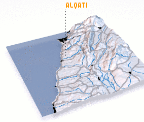 Places with similar names to Al Qāţi‘, Lebanon ::
Disclaimer :: Information on this page comes without warranty of any kind |
||
|
Where is Al Qāţi‘? Elevation and coordinates ::
Latitude (lat): 33°41'0"N Longitude (lon): 35°29'0"E
Elevation (approx.): 306m (map arrows pan, magnifying glasses zoom) |
||
|
Visiting Al Qāţi‘? Hotel/Accommodation ::
Book a hotel in Al Qāţi‘ Travel Guide ::
Buy a travel guide for Lebanon rental cars ::
car rental offers GPS waypoint ::
download a GPX waypoint (PoI) of Al Qāţi‘ for your GPS receiver
|
||