|
search place name
|
||
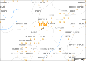
Btid‘ī (Béqaa, Lebanon)Btid‘ī is a town in the Béqaa region of Lebanon. An overview map of the region around Btid‘ī is displayed below.
regional and 3d topo map of Btid‘ī, Lebanon ::
Btid‘ī airports ::
The nearest airport is BEY - Beirut Rafic Hariri Intl, located 65.4 km south west of Btid‘ī.
Other airports nearby include DAM - Damascus Intl (87.2 km south east), RPN - Rosh Pina Mahanaim I Ben Yaakov (135.2 km south), LTK - Latakia Bassel Al Assad Intl (143.2 km north), HFA - Haifa (175.1 km south west), Nearby towns ::
Dayr al Aḩmar (1.5km east) //
Mazra‘at Bayt al Ghuşayn (1.5km west) //
Marāḩ Bū Shāhīn (1.5km west) //
Buşaylat al Fawqā (2.4km north east) //
Marāḩ al ‘Awjāʼ (2.4km north west) //
Marāḩ Bayt al Quzaḩ (2.4km north east) //
Buşaylat at Taḩtā (2.4km north east) //
Marāḩ as Sayyid (2.4km south west) //
Mazra‘at Maţar (2.4km south west) //
Bayt Ḩabashī (3.7km north) //
Al Qarrāmī (3.7km north) //
Bulayqah (3.7km north) //
Shlīfā (3.7km south) //
Marāḩ al Wādī (3.6km north east) //
Marāḩ al Qulūd (3.6km north west) //
Az Zarāzīr (4.0km north) //
Al Mushaytīyah (4.0km north) //
Marāḩ Najīb (3.6km south west) //
Zarāʼib Shukr (3.6km south west) //
Al Ḩāʼūz (3.6km south west) //
Marāḩ al Jājah (4.8km north east) //
Bshawāt (4.8km north east) //
Marāḩ Rūḩānā (4.8km north east) //
Al Ḩafāʼir (4.8km south west) //
Al Qa‘qīyah (5.8km south) //
Maql al Bawāditah (5.0km west) //
Dār al Wāsi‘ah (5.0km west) //
Az Zarāʼib (5.0km west) //
Al Marmaghah (5.0km west) //
[all distances 'as the bird flies' and approximate] 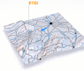 Places with similar names to Btid‘ī, Lebanon ::
Disclaimer :: Information on this page comes without warranty of any kind |
||
|
Where is Btid‘ī? Elevation and coordinates ::
Latitude (lat): 34°7'0"N Longitude (lon): 36°6'0"E
Elevation (approx.): 1093m (map arrows pan, magnifying glasses zoom) |
||
|
Visiting Btid‘ī? Hotel/Accommodation ::
Book a hotel in Btid‘ī Travel Guide ::
Buy a travel guide for Lebanon rental cars ::
car rental offers GPS waypoint ::
download a GPX waypoint (PoI) of Btid‘ī for your GPS receiver
|
||