|
search place name
|
||
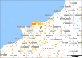
Dayr ‘Ammār (Liban-Nord, Lebanon)Dayr ‘Ammār is a town in the Liban-Nord region of Lebanon. An overview map of the region around Dayr ‘Ammār is displayed below.
regional and 3d topo map of Dayr ‘Ammār, Lebanon ::
Dayr ‘Ammār airports ::
The nearest airport is BEY - Beirut Rafic Hariri Intl, located 79.4 km south west of Dayr ‘Ammār.
Other airports nearby include LTK - Latakia Bassel Al Assad Intl (105.6 km north), DAM - Damascus Intl (128.5 km south east), RPN - Rosh Pina Mahanaim I Ben Yaakov (165.7 km south), HFA - Haifa (198.6 km south west), Nearby towns ::
Burj al Yahūdīyah (1.5km east) //
‘Almā (1.9km south) //
Ḩayy Ḩamdūn (2.4km north east) //
Bayt ‘Awkar (2.4km south east) //
Būsīţ (2.4km south east) //
Al Fawwār (2.4km south west) //
Bayt ‘Ubayd (2.4km south east) //
Al Madīnah al Jadīdah (3.1km west) //
Wādī an Naḩlah (3.1km west) //
Al Baddāwī (3.1km west) //
Ḩurayqis (3.1km east) //
An Nabī Yūsha‘ (3.6km north east) //
Ḩayy al Balāţ (3.6km north east) //
Bshāmā (3.6km south east) //
Rmaïla (4.4km south) //
Hâret el Baklîl (4.5km south) //
Hâret ej Jdîdé (4.5km south west) //
Ardé (4.8km south) //
Aardât (4.8km south) //
El Qâdrîyé (4.7km south east) //
El Aaqbé (5.1km south) //
Al Minyah (4.8km north east) //
Ḩayy al Maqāţi‘ (4.8km north east) //
Majdalayyā (4.8km south west) //
Ḩayy al ‘Atīqah (4.8km north east) //
Miryāţah (4.8km south east) //
Bayt Qnātī (4.8km south east) //
Tâhoûn Nahloûs (5.3km south) //
Harf Ardé (5.4km south) //
[all distances 'as the bird flies' and approximate] 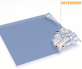 Places with similar names to Dayr ‘Ammār, Lebanon ::
Disclaimer :: Information on this page comes without warranty of any kind |
||
|
Where is Dayr ‘Ammār? Elevation and coordinates ::
Latitude (lat): 34°27'0"N Longitude (lon): 35°54'0"E
Elevation (approx.): 258m (map arrows pan, magnifying glasses zoom) |
||
|
Visiting Dayr ‘Ammār? Hotel/Accommodation ::
Book a hotel in Dayr ‘Ammār Travel Guide ::
Buy a travel guide for Lebanon rental cars ::
car rental offers GPS waypoint ::
download a GPX waypoint (PoI) of Dayr ‘Ammār for your GPS receiver
|
||