|
search place name
|
||
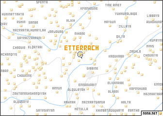
Et Terrâch (Lebanon)Et Terrâch is a town in Lebanon. An overview map of the region around Et Terrâch is displayed below.
regional and 3d topo map of Et Terrâch, Lebanon ::
Et Terrâch airports ::
The nearest airport is RPN - Rosh Pina Mahanaim I Ben Yaakov, located 46.5 km south of Et Terrâch.
Other airports nearby include BEY - Beirut Rafic Hariri Intl (47.4 km north), HFA - Haifa (82.2 km south west), DAM - Damascus Intl (87.4 km east), OMF - Mafraq King Hussein (132.3 km south east), Nearby towns ::
Mazraat el Ouazaaïyé (0.8km south west) //
Mazraat el Ouazaaïyé (0.8km south west) //
Mazraat el Ouazaaïyé (0.8km south west) //
Mazraat el Ouazaaïyé (0.8km south west) //
Mazraat es Souaïri (1.3km north) //
Mazraat es Souaïri (1.3km north) //
Mazraat es Souaïri (1.3km north) //
Mazraat es Souaïri (1.3km north) //
Ed Dellâché (1.5km north west) //
El Makhloûta (1.6km west) //
Ech Chouthâne (1.8km north west) //
El Aaïchîyé (1.8km north west) //
El Khiché (1.9km north west) //
Mazraat Louzîd (2.1km north east) //
Mazraat el Loûzîd (2.1km north east) //
El Ouardîyé (1.8km east) //
Mazraat Khallet Khâzene (2.8km north) //
Mazraat Qrouh (2.9km north) //
Hâret en Nabaa (2.6km north west) //
El Mahmoûdîyé (2.6km south west) //
El Hamra (2.6km east) //
Blât (2.8km south east) //
Snaoubar el Haché (3.1km north east) //
Mazraat Zaghrîne (3.2km north west) //
Chbaïl (3.6km north east) //
Ech Châoui (3.8km north east) //
Marjayoûn (4.0km south) //
Dibbîne (3.8km south east) //
Mazraat el Aarqoûb (3.5km west) //
[all distances 'as the bird flies' and approximate]  Places with similar names to Et Terrâch, Lebanon ::
Disclaimer :: Information on this page comes without warranty of any kind |
||
|
Where is Et Terrâch? Elevation and coordinates ::
Latitude (lat): 33°24'0"N Longitude (lon): 35°34'30"E
Elevation (approx.): 548m (map arrows pan, magnifying glasses zoom) |
||
|
Visiting Et Terrâch? Hotel/Accommodation ::
Book a hotel in Et Terrâch Travel Guide ::
Buy a travel guide for Lebanon rental cars ::
car rental offers GPS waypoint ::
download a GPX waypoint (PoI) of Et Terrâch for your GPS receiver
|
||