|
search place name
|
||
Shamlīkh (Mont-Liban, Lebanon)Shamlīkh is a town in the Mont-Liban region of Lebanon. An overview map of the region around Shamlīkh is displayed below.
regional and 3d topo map of Shamlīkh, Lebanon ::

Shamlīkh airports ::
The nearest airport is BEY - Beirut Rafic Hariri Intl, located 20.0 km west of Shamlīkh.
Other airports nearby include DAM - Damascus Intl (86.1 km south east), RPN - Rosh Pina Mahanaim I Ben Yaakov (89.8 km south), HFA - Haifa (124.1 km south west), OMF - Mafraq King Hussein (166.7 km south), Nearby towns ::
Al ‘Azzūnīyah (1.9km south) //
Şawfar (1.9km north) //
Khazzān Şawfar (1.9km north) //
At Tuwaytah (1.5km east) //
Shārūn (1.9km south west) //
‘Ayn Şawfar (2.1km north) //
Ruʼaysāt Şawfar (2.4km north west) //
Aghmīd (2.7km south) //
‘Ayn Dārah (2.4km east) //
Bmahrāy (3.4km south east) //
Mashqītī (3.7km south) //
Majdal Ba‘nā (3.1km west) //
Nab‘ aş Şafā (3.7km south) //
Dayr Mār Yūḩannā (3.7km north) //
Badghān (3.3km south west) //
Al Mudayrij (3.6km north east) //
Al Qurayyah (3.6km north west) //
Al Qaşr (4.0km south west) //
Al Khuraybah (4.0km north east) //
Ash Shabānīyah (4.0km north east) //
Qibbay‘ (4.0km north west) //
Ruʼaysat Qibbay‘ (4.0km north west) //
Dayr Mār Yūḩannā (4.0km north west) //
Al Murayjāt (4.8km south west) //
Al Ḩaffah (4.8km north east) //
Ash Shāghūr (4.8km north east) //
Ḩārat Ḩamzah (4.8km north west) //
Raʼs al Ḩarf (4.8km north west) //
Qtālah (4.8km north west) //
[all distances 'as the bird flies' and approximate] 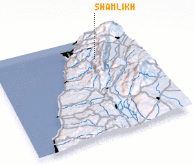 Places with similar names to Shamlīkh, Lebanon ::
// Chambalkē (IQ)
// Chmielek (PL)
// Chmielewko (PL)
// Chmielówka (PL)
// Chmielówka (PL)
// Chamlyk (RU)
// Chāh Malek (IR)
// Chimulco (MX)
// Shamalyk (KG)
// Chimbaylyk (UZ)
Disclaimer :: Information on this page comes without warranty of any kind |
||
|
Where is Shamlīkh? Elevation and coordinates ::
Latitude (lat): 33°47'0"N Longitude (lon): 35°42'0"E
Elevation (approx.): 1289m (map arrows pan, magnifying glasses zoom) |
||
|
Visiting Shamlīkh? Hotel/Accommodation ::
Book a hotel in Shamlīkh Travel Guide ::
Buy a travel guide for Lebanon rental cars ::
car rental offers GPS waypoint ::
download a GPX waypoint (PoI) of Shamlīkh for your GPS receiver
|
||