|
search place name
|
||
Abū Ḩajar al A‘lá (Jīzān, Saudi Arabia)Abū Ḩajar al A‘lá is a town in the Jīzān region of Saudi Arabia. An overview map of the region around Abū Ḩajar al A‘lá is displayed below.
regional and 3d topo map of Abū Ḩajar al A‘lá, Saudi Arabia ::

Abū Ḩajar al A‘lá airports ::
The nearest airport is GIZ - Gizan King Abdullah Bin Abdulaziz, located 53.1 km north west of Abū Ḩajar al A‘lá.
Other airports nearby include AHB - Abha (176.8 km north), EAM - Nejran (180.0 km north east), Nearby towns ::
Abū Kirsh (0.4km east) //
Abū Ḩajar Ūlá (1.4km west) //
Al Luqīyah (2.8km south) //
Marāḩ (3.7km south west) //
Minjarah (3.9km north) //
Al Qufūl (5.4km east) //
Sūq al Layl (5.5km north west) //
Ḩāsim (5.6km west) //
Al Jāḑi (5.8km south west) //
Umm ‘Araj (6.1km north) //
Jathā Banī Shubayl (6.2km south west) //
Al Qāʼim (7.1km north west) //
Bayţārīyah (7.6km north west) //
Adh Dhaghārīr (7.6km west) //
Khidlan (7.7km east) //
Al Maḩaţţah (7.8km east) //
Ramdah (8.7km north west) //
Aḩad al Masāriḩah (8.7km west) //
Mu‘jar (9.5km south west) //
Ar Rukūbah (9.7km south west) //
Al Kharābah (11.3km north west) //
[all distances 'as the bird flies' and approximate] 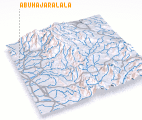 Places with similar names to Abū Ḩajar al A‘lá, Saudi Arabia :: Disclaimer :: Information on this page comes without warranty of any kind |
||
|
Where is Abū Ḩajar al A‘lá? Elevation and coordinates ::
Latitude (lat): 16°41'2"N Longitude (lon): 43°1'47"E
Elevation (approx.): 95m (map arrows pan, magnifying glasses zoom) |
||
|
Visiting Abū Ḩajar al A‘lá? Hotel/Accommodation ::
Book a hotel in Abū Ḩajar al A‘lá Travel Guide ::
rental cars ::
car rental offers GPS waypoint ::
download a GPX waypoint (PoI) of Abū Ḩajar al A‘lá for your GPS receiver
|
||