|
search place name
|
||
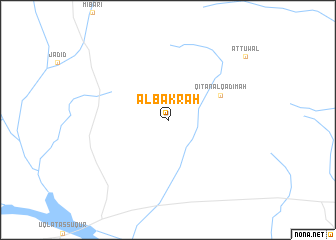
Al Bakrah (Saudi Arabia)Al Bakrah is a town in Saudi Arabia. An overview map of the region around Al Bakrah is displayed below.
regional and 3d topo map of Al Bakrah, Saudi Arabia ::
Al Bakrah airports ::
The nearest airport is ELQ - Gassim, located 151.6 km east of Al Bakrah.
Other airports nearby include HAS - Hail (176.9 km north), Nearby towns ::
Qiţan al Qadīmah (6.0km north east) //
Aţ Ţuwāl (10.5km north east) //
[all distances 'as the bird flies' and approximate]  Places with similar names to Al Bakrah, Saudi Arabia ::
// Ālia Bākri (BD)
// Al Buqayr (SD)
// Al Buqayr (SD)
// Alo Bagarai (PK)
// Al Bakhrāʼ (SA)
// Al Bāqūrah (JO)
// Al Bakrī (SD)
Disclaimer :: Information on this page comes without warranty of any kind |
||
|
Where is Al Bakrah? Elevation and coordinates ::
Latitude (lat): 25°56'37"N Longitude (lon): 42°18'40"E
Elevation (approx.): 843m (map arrows pan, magnifying glasses zoom) |
||
|
Visiting Al Bakrah? Hotel/Accommodation ::
Book a hotel in Al Bakrah Travel Guide ::
rental cars ::
car rental offers GPS waypoint ::
download a GPX waypoint (PoI) of Al Bakrah for your GPS receiver
|
||