|
search place name
|
||
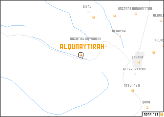
Al Qunayţirah (Saudi Arabia)Al Qunayţirah is a town in Saudi Arabia. An overview map of the region around Al Qunayţirah is displayed below.
regional and 3d topo map of Al Qunayţirah, Saudi Arabia ::
Al Qunayţirah airports ::
The nearest airport is AJO - Al-jouf Al Jouf, located 21.4 km south of Al Qunayţirah.
Other airports nearby include RAE - Arar (143.8 km north east), TUI - Turaif (230.5 km north west), Nearby towns ::
Mazāti‘ al Kaysūmah (3.6km north) //
Al Qar‘āʼ (5.4km north east) //
Al Bayḑāʼ (9.2km north east) //
[all distances 'as the bird flies' and approximate]  Places with similar names to Al Qunayţirah, Saudi Arabia ::
// Alcântara (PT)
// Alcoentre (PT)
// Al Qanţarah (EG)
// Alcanadre (ES)
// Alcántara (ES)
// Alcántara (ES)
// Alcóntar (ES)
// Al Qanţārī (LB)
// Al Qunayţirah (JO)
// Al Qanāţir (SY)
Disclaimer :: Information on this page comes without warranty of any kind |
||
|
Where is Al Qunayţirah? Elevation and coordinates ::
Latitude (lat): 29°58'40"N Longitude (lon): 40°5'35"E
Elevation (approx.): 599m (map arrows pan, magnifying glasses zoom) |
||
|
Visiting Al Qunayţirah? Hotel/Accommodation ::
Book a hotel in Al Qunayţirah Travel Guide ::
rental cars ::
car rental offers GPS waypoint ::
download a GPX waypoint (PoI) of Al Qunayţirah for your GPS receiver
|
||