|
search place name
|
||
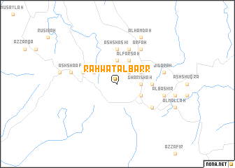
Rahwat al Barr (Saudi Arabia)Rahwat al Barr is a town in Saudi Arabia. An overview map of the region around Rahwat al Barr is displayed below.
regional and 3d topo map of Rahwat al Barr, Saudi Arabia ::
Rahwat al Barr airports ::
The nearest airport is ABT - El-baha Al Baha, located 35.5 km north east of Rahwat al Barr.
Other airports nearby include BHH - Bisha (126.2 km east), TIF - Taif (182.9 km north west), AHB - Abha (239.0 km south east), Nearby towns ::
Ar Rubian (2.5km north east) //
Musaghir (3.7km north) //
Arbal Allāh (3.5km east) //
Ghar ‘Ishah (3.5km east) //
Al Jadyah (3.5km east) //
Al Farsah (4.1km north east) //
Mulaykah (4.1km north east) //
Ar Rūmī (4.1km north east) //
Al Athamah (3.9km north east) //
Raghdān (3.9km south east) //
Karīnah (3.9km north west) //
Al Ḩabashī (5.2km east) //
Āl Musá (5.6km north) //
Al Jith (5.6km north) //
Ash Shashi (5.6km north) //
Al Qarn (5.8km north) //
Al ‘Āmirah (5.8km north) //
Al ‘Afus (5.5km west) //
Al Bāḩah (6.4km south east) //
‘Arfah (6.6km north east) //
Banī Sār (6.6km north east) //
Jidārah (7.2km east) //
Al Bashīr (7.2km east) //
Ash Sha‘af (7.2km west) //
Āl Ḩamdah (8.2km north east) //
[all distances 'as the bird flies' and approximate] 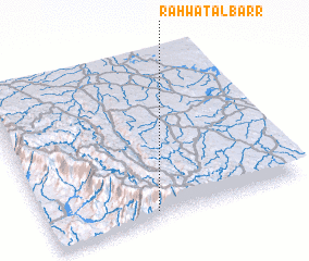 Places with similar names to Rahwat al Barr, Saudi Arabia :: Disclaimer :: Information on this page comes without warranty of any kind |
||
|
Where is Rahwat al Barr? Elevation and coordinates ::
Latitude (lat): 20°3'0"N Longitude (lon): 41°25'0"E
Elevation (approx.): 2422m (map arrows pan, magnifying glasses zoom) |
||
|
Visiting Rahwat al Barr? Hotel/Accommodation ::
Book a hotel in Rahwat al Barr Travel Guide ::
rental cars ::
car rental offers GPS waypoint ::
download a GPX waypoint (PoI) of Rahwat al Barr for your GPS receiver
|
||