|
search place name
|
||
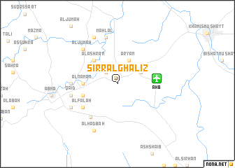
Sirr Āl Ghalīz̧ (Saudi Arabia)Sirr Āl Ghalīz̧ is a town in Saudi Arabia. An overview map of the region around Sirr Āl Ghalīz̧ is displayed below.
regional and 3d topo map of Sirr Āl Ghalīz̧, Saudi Arabia ::
Sirr Āl Ghalīz̧ airports ::
The nearest airport is AHB - Abha, located 6.0 km east of Sirr Āl Ghalīz̧.
Other airports nearby include GIZ - Gizan King Abdullah Bin Abdulaziz (147.5 km south), BHH - Bisha (193.8 km north), EAM - Nejran (204.7 km east), Nearby towns ::
Al Assan (2.6km north west) //
Ḩajlah (4.0km north east) //
‘Aryam (4.1km north east) //
Al Ashram (5.1km north west) //
Al Naman (5.3km west) //
Al Falt (5.3km west) //
Ad Dār as Suflá (5.6km west) //
Al Falāḩ (6.5km south west) //
Al Ḩişn al Adshfar (6.5km south west) //
Aḩad Marrāt (6.7km south west) //
Al ‘Arīn (7.0km west) //
Qāʼid (7.3km west) //
Yuhan (7.3km west) //
Mahlal (7.6km north) //
Al Jum‘ah (7.7km north west) //
Al Haḑbah (8.2km south west) //
Banī Mālik (8.2km north west) //
Al Ḩişn al Ala (8.0km south west) //
[all distances 'as the bird flies' and approximate] 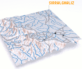 Places with similar names to Sirr Āl Ghalīz̧, Saudi Arabia :: Disclaimer :: Information on this page comes without warranty of any kind |
||
|
Where is Sirr Āl Ghalīz̧? Elevation and coordinates ::
Latitude (lat): 18°14'0"N Longitude (lon): 42°36'0"E
Elevation (approx.): 2124m (map arrows pan, magnifying glasses zoom) |
||
|
Visiting Sirr Āl Ghalīz̧? Hotel/Accommodation ::
Book a hotel in Sirr Āl Ghalīz̧ Travel Guide ::
rental cars ::
car rental offers GPS waypoint ::
download a GPX waypoint (PoI) of Sirr Āl Ghalīz̧ for your GPS receiver
|
||